Howmeh Rural District (Deyr County)
Appearance
Howmeh Rural District
Persian: دهستان حومه | |
|---|---|
| Coordinates: 27°56′37″N 51°57′27″E / 27.94361°N 51.95750°E[1] | |
| Country | Iran |
| Province | Bushehr |
| County | Deyr |
| District | Central |
| Capital | Dowrahak |
| Population (2016)[2] | |
• Total | 2,963 |
| Time zone | UTC+3:30 (IRST) |
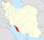
Howmeh Rural District (Persian: دهستان حومه) is in the Central District of Deyr County, Bushehr province, Iran. It is administered from the city of Dowrahak.[3]
Demographics
[edit]Population
[edit]At the time of the 2006 National Census, the rural district's population was 12,939 in 2,694 households.[4] There were 8,621 inhabitants in 2,155 households at the following census of 2011.[5] The 2016 census measured the population of the rural district as 2,963 in 775 households. The most populous of its 22 villages was Lombadan-e Balai, with 1,256 people.[2]
Other villages in the rural district include Bonay-ye Rashed, Lombadan-e Hajjiabad, and Lombadan-e Pain.
See also
[edit]References
[edit]- ^ OpenStreetMap contributors (26 August 2024). "Howmeh Rural District (Deyr County)" (Map). OpenStreetMap (in Persian). Retrieved 26 August 2024.
- ^ a b Census of the Islamic Republic of Iran, 1395 (2016): Bushehr Province. amar.org.ir (Report) (in Persian). The Statistical Center of Iran. Archived from the original (Excel) on 3 August 2017. Retrieved 19 December 2022.
- ^ Carrying out reforms in the rural districts of Bushehr province (Report) (in Persian). Ministry of the Interior, Defense Political Commission of the Government Council. 29 August 1370. Amendment to Notification 71144/T142K – via rc.majlis.ir/fa/law/show/113212 (Islamic Parliament Research Center).
A: The name of Khoshmakan Rural District should be changed to Howmeh and its center to Sar Korreh village. B: Ziarat Rural District should be changed to Ziarat village as its center, including the following villages, farms and places:...B: Liravi Rural District will be renamed Liravi-ye Shomali Rural District. C: Liravi-ye Jonubi Rural District, centered on the village of Emam Hasan...A: The villages of Barikan, Wazir-e-Ahak, will be separated from Kabgan Rural District and will be merged with Bu ol Kheyr Rurall District, Tangestan County. B: Howmeh Rural District centered on Dowrahak village including the following villages, farms and places: 1 - Gaznak, 2 - Bataneh, 3 - Jobrani Bala and Payin, 4 - Bibi...
- ^ Census of the Islamic Republic of Iran, 1385 (2006): Bushehr Province. amar.org.ir (Report) (in Persian). The Statistical Center of Iran. Archived from the original (Excel) on 20 September 2011. Retrieved 25 September 2022.
- ^ Census of the Islamic Republic of Iran, 1390 (2011): Bushehr Province. irandataportal.syr.edu (Report) (in Persian). The Statistical Center of Iran. Archived from the original (Excel) on 3 April 2023. Retrieved 19 December 2022 – via Iran Data Portal, Syracuse University.


