
Anchor Bay, California
Anchor Bay | |
|---|---|
 Anchor Bay in April 2023. | |
 Location of Anchor Bay in Mendocino County, California | |
 Anchor Bay Location in California | |
| Coordinates: 38°48′10″N 123°34′40″W / 38.80278°N 123.57778°W | |
| Country | |
| State | |
| County | Mendocino |
| Area | |
• Total | 3.51 sq mi (9.10 km2) |
| • Land | 3.51 sq mi (9.10 km2) |
| • Water | 0.00 sq mi (0.00 km2) 0% |
| Elevation | 105 ft (32 m) |
| Population (2020) | |
• Total | 473 |
| • Density | 134.64/sq mi (51.99/km2) |
| Time zone | UTC-8 (Pacific (PST)) |
| • Summer (DST) | UTC-7 (PDT) |
| ZIP code | 95445[3] |
| Area code | 707 |
| GNIS feature IDs | 1657928; 2628706 |
| U.S. Geological Survey Geographic Names Information System: Anchor Bay, California; U.S. Geological Survey Geographic Names Information System: Anchor Bay, California | |
Anchor Bay (formerly Anchor Bay Settlement) is a census-designated place[4] in Mendocino County, California.[2] It is located 3.5 miles (5.6 km) northwest of Gualala,[5] at an elevation of 105 feet (32 m).[2] The population was 473 at the 2020 census.
Geography
[edit]According to the United States Census Bureau, the CDP covers an area of 3.5 square miles (9.1 km2), all of it land.
Climate
[edit]The climate of Anchor Bay is Mediterranean, characterized by warm, dry summers, at times exceeding 78 °F or 25.6 °C, and mild, rainy winters, with lows at night falling below freezing at times.
| Climate data for Anchor Bay, California | |||||||||||||
|---|---|---|---|---|---|---|---|---|---|---|---|---|---|
| Month | Jan | Feb | Mar | Apr | May | Jun | Jul | Aug | Sep | Oct | Nov | Dec | Year |
| Mean daily maximum °F (°C) | 58 (14) |
59 (15) |
60 (16) |
61 (16) |
63 (17) |
65 (18) |
67 (19) |
68 (20) |
69 (21) |
67 (19) |
62 (17) |
58 (14) |
63 (17) |
| Mean daily minimum °F (°C) | 40 (4) |
43 (6) |
43 (6) |
43 (6) |
47 (8) |
49 (9) |
51 (11) |
51 (11) |
50 (10) |
46 (8) |
42 (6) |
40 (4) |
45 (7) |
| Average rainfall inches (mm) | 7.2 (180) |
6.1 (150) |
5.6 (140) |
3.0 (76) |
0.6 (15) |
0.2 (5.1) |
0.2 (5.1) |
0.5 (13) |
0.9 (23) |
2.5 (64) |
6.0 (150) |
7.4 (190) |
40.2 (1,011.2) |
| Average rainy days | 10 | 9 | 10 | 6 | 2 | 1 | 0 | 1 | 2 | 5 | 8 | 10 | 64 |
| Source: [6] | |||||||||||||
Demographics
[edit]| Census | Pop. | Note | %± |
|---|---|---|---|
| 2010 | 340 | — | |
| 2020 | 473 | 39.1% | |
| U.S. Decennial Census[7] 1850–1870[8][9] 1880-1890[10] 1900[11] 1910[12] 1920[13] 1930[14] 1940[15] 1950[16] 1960[17] 1970[18] 1980[19] 1990[20] 2000[21] 2010[22] | |||
The 2020 United States census reported that Anchor Bay had a population of 473. The population density was 134.6 inhabitants per square mile (52.0/km2). The racial makeup of Anchor Bay was 83.5% White, 0.0% African American, 0.8% Native American, 0.8% Asian, 0.0% Pacific Islander, 5.1% from other races, and 9.7% from two or more races. Hispanic or Latino of any race were 7.6% of the population.
The whole population lived in households.
There were 246 households, out of which 7.7% included children under the age of 18, 42.3% were married-couple households, 8.1% were cohabiting couple households, 28.5% had a female householder with no partner present, and 21.1% had a male householder with no partner present. 39.4% of households were one person, and 22.4% were one person aged 65 or older. The average household size was 1.92. There were 129 families (52.4% of all households).
The age distribution was 7.8% under the age of 18, 4.0% aged 18 to 24, 17.3% aged 25 to 44, 38.1% aged 45 to 64, and 32.8% who were 65 years of age or older. The median age was 60.4 years. For every 100 females, there were 81.2 males.
There were 372 housing units at an average density of 105.9 units per square mile (40.9 units/km2), of which 246 (66.1%) were occupied. Of these, 80.1% were owner-occupied, and 19.9% were occupied by renters.[23][24]
Politics
[edit]In the state legislature, Anchor Bay is in the 2nd senatorial district, represented by Democrat Mike McGuire,[25] and the 2nd Assembly district, represented by Democrat Chris Rogers.[26]
Federally, Anchor Bay is in California's 2nd congressional district, represented by Democrat Jared Huffman.[27]
Personalities
[edit]This section is empty. You can help by adding to it. (July 2023) |
References
[edit]- ^ "2020 U.S. Gazetteer Files". United States Census Bureau. Retrieved October 30, 2021.
- ^ a b c U.S. Geological Survey Geographic Names Information System: Anchor Bay, California
- ^ "Anchor Bay CA ZIP Code". zipdatamaps.com. 2023. Retrieved February 17, 2023.
- ^ U.S. Geological Survey Geographic Names Information System: Anchor Bay, California
- ^ Durham, David L. (1998). California's Geographic Names: A Gazetteer of Historic and Modern Names of the State. Clovis, California: Word Dancer Press. p. 9. ISBN 1-884995-14-4.
- ^ . National Oceanic and Atmospheric Administration https://www.ncei.noaa.gov.
{{cite web}}: Missing or empty|title=(help) - ^ "Decennial Census by Decade". United States Census Bureau.
- ^ "1870 Census of Population - Population of Civil Divisions less than Counties - California - Almeda County to Sutter County" (PDF). United States Census Bureau.
- ^ "1870 Census of Population - Population of Civil Divisions less than Counties - California - Tehama County to Yuba County" (PDF). United States Census Bureau.
- ^ "1890 Census of Population - Population of California by Minor Civil Divisions" (PDF). United States Census Bureau.
- ^ "1900 Census of Population - Population of California by Counties and Minor Civil Divisions" (PDF). United States Census Bureau.
- ^ "1910 Census of Population - Supplement for California" (PDF). United States Census Bureau.
- ^ "1920 Census of Population - Number of Inhabitants - California" (PDF). United States Census Bureau.
- ^ "1930 Census of Population - Number and Distribution of Inhabitants - California" (PDF). United States Census Bureau.
- ^ "1940 Census of Population - Number of Inhabitants - California" (PDF). United States Census Bureau.
- ^ "1950 Census of Population - Number of Inhabitants - California" (PDF). United States Census Bureau.
- ^ "1960 Census of Population - General population Characteristics - California" (PDF). United States Census Bureau.
- ^ "1970 Census of Population - Number of Inhabitants - California" (PDF). United States Census Bureau.
- ^ "1980 Census of Population - Number of Inhabitants - California" (PDF). United States Census Bureau.
- ^ "1990 Census of Population - Population and Housing Unit Counts - California" (PDF). United States Census Bureau.
- ^ "2000 Census of Population - Population and Housing Unit Counts - California" (PDF). United States Census Bureau.
- ^ "2010 Census of Population - Population and Housing Unit Counts - California" (PDF). United States Census Bureau.
- ^ "Anchor Bay CDP, California; DP1: Profile of General Population and Housing Characteristics - 2020 Census of Population and Housing". US Census Bureau. Retrieved March 31, 2025.
- ^ "Anchor Bay CDP, California; P16: Household Type - 2020 Census of Population and Housing". US Census Bureau. Retrieved March 31, 2025.
- ^ "Senators". State of California. Retrieved March 10, 2013.
- ^ "Members Assembly". State of California. Retrieved March 2, 2013.
- ^ "California's 2nd Congressional District - Representatives & District Map". Civic Impulse, LLC. Retrieved March 1, 2013.
Municipalities and communities of Mendocino County, California, United States | ||
|---|---|---|
| Cities | 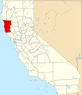 | |
| CDPs | ||
| Unincorporated communities |
| |
| Indian reservations | ||
| Former settlements | ||
| Footnotes | ‡This populated place also has portions in an adjacent county or counties | |