
Zara, North Carolina
Zara | |
|---|---|
 Location within the U.S. state of North Carolina | |
 Zara Location within the U.S. state of North Carolina | |
| Coordinates: 34°26′N 78°22′W / 34.43°N 78.36°W | |
| Country | |
| State | North Carolina |
| County | Bladen |
| Elevation | 66 ft (20 m) |
| Time zone | UTC-5 (EST) |
| • Summer (DST) | UTC-4 (EDT) |
| ZIP Code | 28456 |
| Area code(s) | 910, 472 |
Zara is an unincorporated community in Bladen County, North Carolina, United States.[1][2][3][4]
Geography
[edit]Zara is located along NC 87 in southeastern Bladen County, northwest of Sandyfield. The community is 28 miles (45 km) northwest of Wilmington.
The elevation of Zara is 66 feet (20 m).[4]
The ZIP Code for Zara is 28456.[5]
References
[edit]- ^ "Zara Populated Place Profile / Bladen County, North Carolina Data". northcarolina.hometownlocator.com. Retrieved March 16, 2025.
- ^ "Zara, NC 28456, US - MapQuest". www.mapquest.com. Retrieved March 16, 2025.
- ^ "Zara (Bladen County, NC)". roadsidethoughts.com. Retrieved March 16, 2025.
- ^ a b "Zara Topo Map NC, Bladen County (Kelly Area)". www.topozone.com. Retrieved March 16, 2025.
- ^ "ZIP Code 28456 - Free ZIP Code Map, Statistics, Shipping, and More". www.unitedstateszipcodes.org. Archived from the original on July 12, 2014. Retrieved March 16, 2025.
Municipalities and communities of Bladen County, North Carolina, United States | ||
|---|---|---|
| Towns | 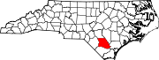 | |
| CDPs | ||
| Unincorporated communities | ||