
Ruhstorf an der Rott
You can help expand this article with text translated from the corresponding article in German. (March 2009) Click [show] for important translation instructions.
|
Ruhstorf a.d.Rott | |
|---|---|
 Church of the Virgin Mary | |
 Coat of arms | |
Location of Ruhstorf a.d.Rott within Passau district 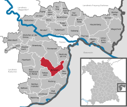 | |
 Ruhstorf a.d.Rott  Ruhstorf a.d.Rott | |
| Coordinates: 48°26′16″N 13°20′10″E / 48.43778°N 13.33611°E | |
| Country | Germany |
| State | Bavaria |
| Admin. region | Niederbayern |
| District | Passau |
| Government | |
| • Mayor (2020–26) | Andreas Jakob[1] (CSU) |
| Area | |
• Total | 51.39 km2 (19.84 sq mi) |
| Elevation | 319 m (1,047 ft) |
| Population (2024-12-31)[2] | |
• Total | 7,115 |
| • Density | 140/km2 (360/sq mi) |
| Time zone | UTC+01:00 (CET) |
| • Summer (DST) | UTC+02:00 (CEST) |
| Postal codes | 94099 |
| Dialling codes | 08531 |
| Vehicle registration | PA |
| Website | www.ruhstorf.de |
Ruhstorf (Central Bavarian: Ruaschtoaf or Ruaschdoaf) is a municipality in the district of Passau in Bavaria in Germany. In Ruhstorf, there is a music school and there are two different churches, the „Marienkirche“ (church of the Virgin Mary) and the „Pfarrkirche Christkönig“ (church of Jesus Christ, the king).
Hatz has its seat in the geographic middle of the district.
Mayor
[edit]The current mayor of Ruhstorf is Andreas Jakob.
References
[edit]- ^ Liste der ersten Bürgermeister/Oberbürgermeister in kreisangehörigen Gemeinden, Bayerisches Landesamt für Statistik, 15 July 2021.
- ^ "Gemeinden, Kreise und Regierungsbezirke in Bayern, Einwohnerzahlen am 31. Dezember 2024; Basis Zensus 2022" [Municipalities, counties, and administrative districts in Bavaria; Based on the 2022 Census] (CSV) (in German). Bayerisches Landesamt für Statistik.

| International | |
|---|---|
| National | |
This Passau district location article is a stub. You can help Wikipedia by expanding it. |