Portal:Austria/WD/Hollabrunn
Appearance
This list is automatically generated from data in Wikidata and is periodically updated by Listeriabot.
Edits made within the list area will be removed on the next update!
BDA Modellierungsartefakt
[edit]
Cellar alley
[edit]
Gasthaus
[edit]| # | WD item | article | description | is a | municipality | commons category | picture | coordinates | position map |
|---|---|---|---|---|---|---|---|---|---|
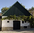
| 1 | Q37716878 | Pulkau Haus Hauptstraße 05 | building in Pulkau, Austria | Gasthaus | Pulkau | Hauptstraße 5 (Pulkau) | 48°42′16″N 15°51′44″E / 48.70441°N 15.86223°E | ||
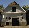
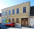
| 2 | Q37728353 | Retz Altstadt Haus Znaimer Straße 14 | building in Retz, Austria | Gasthaus | Retz | Retz Altstadt Haus Znaimer Straße 14 |  |
48°45′32″N 15°57′09″E / 48.7587778°N 15.9524722°E |
Gymnasium
[edit]| # | WD item | article | description | is a | municipality | commons category | picture | coordinates | position map |
|---|---|---|---|---|---|---|---|---|---|
| 1 | Q1006146 | Bundesgymnasium Hollabrunn | gymnasium | Gymnasium | Hollabrunn | Bundesgymnasium Hollabrunn | 48°33′30″N 16°05′00″E / 48.55832°N 16.08341°E | ||
| 2 | Q759506 | Hollabrunn Erzbischöfliches Knabenseminar | gymnasium | Gymnasium school building |
Hollabrunn | Hollabrunn Erzbischöfliches Knabenseminar |  |
48°33′40″N 16°04′57″E / 48.5612°N 16.0824°E |
Holy Trinity column
[edit]
Maria column
[edit]
Natura 2000 site
[edit]| # | WD item | article | description | is a | municipality | commons category | picture | coordinates | position map |
|---|---|---|---|---|---|---|---|---|---|
| 1 | Q128406043 | Thayatal bei Hardegg | protected area in the European Union defined by the habitats directive near Hardegg in the district of Hollabrunn in Lower Austria, Austria | Natura 2000 site | Hardegg | 48°50′30″N 15°50′20″E / 48.8417°N 15.8389°E | |||
| 2 | Q128406052 | Westliches Weinviertel | protected area in the European Union defined by the habitats directive consisting of several sub-areas in the north and northwest of Hollabrunn in Lower Austria, Austria | Natura 2000 site | Hollabrunn | 48°37′30″N 15°54′00″E / 48.625°N 15.9°E |
Ortschaft
[edit]| # | WD item | article | description | is a | municipality | commons category | picture | coordinates | position map |
|---|---|---|---|---|---|---|---|---|---|
| 1 | Q59659888 | Karlsdorf | locality in Hollabrunn District | Ortschaft | Pernersdorf | 48°42′23″N 16°01′18″E / 48.7063888888889°N 16.0216666666667°E | |||
| 2 | Q110831161 | Kleinhaugsdorf | locality in Hollabrunn District | Ortschaft | Haugsdorf | 48°45′13″N 16°03′53″E / 48.7536°N 16.0648°E | |||
| 3 | Q109673309 | Maria Roggendorf | human settlement in Lower Austria | Ortschaft | Wullersdorf | Maria Roggendorf | 48°37′07″N 16°08′11″E / 48.618611111111115°N 16.136388888888888°E | ||
| 4 | Q110929954 | Pfaffendorf | locality in Hollabrunn District | Ortschaft | Pernersdorf | 48°42′18″N 16°01′50″E / 48.705°N 16.0305555555556°E |
Pietà
[edit]| # | WD item | article | description | is a | municipality | commons category | picture | coordinates | position map |
|---|---|---|---|---|---|---|---|---|---|
| 1 | Q37806316 | Pieta Kleinwetzdorf | Pietà | Heldenberg | Pieta Kleinwetzdorf |  |
48°30′00″N 15°57′01″E / 48.50010852805°N 15.950193107128°E | ||
| 2 | Q37791070 | Pietà | Pietà | Guntersdorf |  |
48°38′30″N 15°59′00″E / 48.64167°N 15.98343°E |
Rathaus
[edit]
Rondel enclosure
[edit]| # | WD item | article | description | is a | municipality | commons category | picture | coordinates | position map |
|---|---|---|---|---|---|---|---|---|---|
| 1 | Q133310655 | Kreisgrabenanlage Gfletzgraben | Rondel enclosure | Göllersdorf | No/unknown value | 48°31′17″N 16°09′06″E / 48.52149°N 16.15176°E | |||
| 2 | Q101508099 | Kreisgrabenanlage Kleedorf | Rondel enclosure | Hollabrunn | 48°30′06″N 16°03′09″E / 48.5016°N 16.05261°E | ||||
| 3 | Q37930264 | Kreisgrabenanlage Pranhartsberg II | Rondel enclosure | Sitzendorf an der Schmida | No/unknown value | 48°35′25″N 15°59′11″E / 48.59033°N 15.98651°E | |||
| 4 | Q37810928 | Kreisgrabenanlage Rosenäcker | Rondel enclosure | Hohenwarth-Mühlbach am Manhartsberg | No/unknown value | 48°30′48″N 15°47′40″E / 48.51322°N 15.79455°E |
Throne of Mercy
[edit]
Wikimedia list article
[edit]| # | WD item | article | description | is a | municipality | commons category | picture | coordinates | position map |
|---|---|---|---|---|---|---|---|---|---|
| 1 | Q1771185 | Liste der St.-Florian-Darstellungen im Bezirk Hollabrunn | Wikimedia list article | Wikimedia list article | Hollabrunn District | ||||
| 2 | Q1841028 | Statues of John of Nepomuk in Bezirk Hollabrunn | Wikimedia list article | Wikimedia list article | Hollabrunn District | Statues of John of Nepomuk in Bezirk Hollabrunn |
agricultural structure
[edit]| # | WD item | article | description | is a | municipality | commons category | picture | coordinates | position map |
|---|---|---|---|---|---|---|---|---|---|
| 1 | Q37943817 | Retz Altstadt Wirtschaftsgebäude | building in Retz, Austria | agricultural structure | Retz | Retz Altstadt Wirtschaftsgebäude (ObjektID: 28672) |  |
48°45′33″N 15°57′13″E / 48.75906°N 15.95355°E | |
| 2 | Q37943828 | Wirtschaftsgebäude | building in Retz, Austria | agricultural structure | Retz | Retz Altstadt Wirtschaftsgebäude (ObjektID: 28673) |  |
48°45′33″N 15°57′12″E / 48.7590833°N 15.9534444°E | |
| 3 | Q37863209 | ehemalige Wirtschaftsgebäude des Pfarrhofes | building in Pulkau, Austria | agricultural structure | Pulkau |  |
48°42′26″N 15°51′38″E / 48.70716°N 15.86043°E |
archaeological site
[edit]| # | WD item | article | description | is a | municipality | commons category | picture | coordinates | position map |
|---|---|---|---|---|---|---|---|---|---|
| 1 | Q133770971 | Befestigte Siedlung Schüttfeld | archaeological site | Göllersdorf | 48°31′11″N 16°09′18″E / 48.51983°N 16.15496°E | ||||
| 2 | Q38084553 | Fundzone Nexenhoffeld / Hausberg Nexenhof | archaeological site motte-and-bailey castle |
Wullersdorf | No/unknown value | 48°36′41″N 16°04′45″E / 48.61142°N 16.07927°E |
bell tower
[edit]| # | WD item | article | description | is a | municipality | commons category | picture | coordinates | position map |
|---|---|---|---|---|---|---|---|---|---|
| 1 | Q37815099 | Glockenturm | bell tower | Pernersdorf |  |
48°43′36″N 16°01′42″E / 48.72654°N 16.02838°E | |||
| 2 | Q37845192 | Glockenturm Platt | bell tower | Zellerndorf | Glockenturm Platt |  |
48°40′22″N 15°57′48″E / 48.67264°N 15.96343°E | ||
| 3 | Q37806447 | Glockenturm Unterthern | bell tower | Heldenberg | Glockenturm Unterthern |  |
48°30′28″N 15°59′56″E / 48.50765°N 15.99896°E | ||
| 4 | Q37814535 | bell tower in Peigarten | bell tower | Pernersdorf | Glockenturm in Peigarten, Gemeinde Pernersdorf |  |
48°42′15″N 16°02′48″E / 48.70412°N 16.04659°E |
border checkpoint
[edit]| # | WD item | article | description | is a | municipality | commons category | picture | coordinates | position map |
|---|---|---|---|---|---|---|---|---|---|
| 1 | Q121357410 | Hatě–Kleinhaugsdorf border crossing | border crossing | border checkpoint | Hatě Haugsdorf |
Hatě–Kleinhaugsdorf border crossing |  |
48°45′17″N 16°03′53″E / 48.7548381°N 16.0646461°E | |
| 2 | Q121852420 | Mitterretzbach-Hnanice border crossing | border crossing | border checkpoint | Hnanice Mitterretzbach |
Mitterretzbach-Hnanice border crossing | 48°47′20″N 15°58′53″E / 48.7888222°N 15.9814092°E |
bourgeois house
[edit]
building
[edit]
cadastral municipality of Austria
[edit]
calvary
[edit]| # | WD item | article | description | is a | municipality | commons category | picture | coordinates | position map |
|---|---|---|---|---|---|---|---|---|---|
| 1 | Q1412566 | Calvary of Retz | Listed object in Retz, Lower Austria | calvary | Retz | Kalvarienberg (Retz) | 48°45′46″N 15°56′33″E / 48.7628°N 15.9424°E | ||
| 2 | Q107970759 | Kalvarienberg Retz: Kreuzwegstationen | calvary BDA Modellierungsartefakt |
Retz | Kalvarienberg (Retz) |  |
48°45′41″N 15°56′33″E / 48.76139°N 15.94258°E |
castle
[edit]| # | WD item | article | description | is a | municipality | commons category | picture | coordinates | position map |
|---|---|---|---|---|---|---|---|---|---|
| 1 | Q1013068 | Burg Maissau | castle | castle | Maissau | Burg Maissau |  |
48°34′19″N 15°49′28″E / 48.57198888888889°N 15.824469444444444°E | |
| 2 | Q681948 | Hardegg Castle | rocca | castle museum |
Hardegg | Burg Hardegg |  |
48°51′13″N 15°51′27″E / 48.85355°N 15.85742°E | |
| 3 | Q37731618 | Retz Stadt Burg | building in Retz, Austria | castle | Retz | Retz Stadt Burg (ehemalige) |  |
48°45′29″N 15°57′01″E / 48.7581389°N 15.9502222°E |
castle park
[edit]| # | WD item | article | description | is a | municipality | commons category | picture | coordinates | position map |
|---|---|---|---|---|---|---|---|---|---|
| 1 | Q134906315 | Schlosspark Kleinwetzdorf | castle park | Heldenberg | Schloss Wetzdorf | 48°29′53″N 15°56′56″E / 48.49805555555555°N 15.948888888888888°E | |||
| 2 | Q134932130 | Schlosspark Schönborn | castle park | Göllersdorf | Schloss Schönborn (Göllersdorf) | 48°28′22″N 16°08′31″E / 48.47277777777778°N 16.141944444444444°E |
cemetery
[edit]
cemetery chapel
[edit]| # | WD item | article | description | is a | municipality | commons category | picture | coordinates | position map |
|---|---|---|---|---|---|---|---|---|---|
| 1 | Q37898592 | Cemetery Chapel | cemetery chapel in Zellerndorf, Austria | cemetery chapel | Zellerndorf | Cemetery Chapel (Deinzendorf, municipality Zellerndorf) |  |
48°41′50″N 15°55′51″E / 48.69731°N 15.93073°E | |
| 2 | Q37785982 | Friedhofskapelle | cemetery chapel in Grabern, Austria | cemetery chapel | Grabern | Friedhofskapelle Mittergrabern, Gemeinde Grabern |  |
48°37′05″N 16°00′23″E / 48.6181944°N 16.0064167°E | |
| 3 | Q37812490 | Friedhofskapelle Mailberg | cemetery chapel in Mailberg, Austria | cemetery chapel | Mailberg | Friedhofskirche Mailberg |  |
48°40′25″N 16°11′04″E / 48.67353°N 16.18442°E | |
| 4 | Q37868793 | Hollabrunn Friedhofskapelle | cemetery in Hollabrunn, Austria | cemetery chapel | Hollabrunn | Hollabrunn Friedhofskapelle |  |
48°33′30″N 16°05′20″E / 48.55845°N 16.08875°E |
cemetery cross
[edit]
chapel
[edit]
church building
[edit]
château
[edit]
city fortifications
[edit]| # | WD item | article | description | is a | municipality | commons category | picture | coordinates | position map |
|---|---|---|---|---|---|---|---|---|---|
| 1 | Q101514119 | City wall of Retz | city fortifications | Retz | City wall of Retz |  |
48°45′29″N 15°57′07″E / 48.758167°N 15.951806°E | ||
| 2 | Q37933101 | City wall of Schrattenthal | city fortifications | Schrattenthal | City wall of Schrattenthal |  |
48°43′00″N 15°54′37″E / 48.71672°N 15.91019°E | ||
| 3 | Q133427716 | Stadtbefestigung Hardegg | city fortifications | Hardegg | City wall of Hardegg | ||||
| 4 | Q133266133 | Stadtbefestigung Maissau | city fortifications | Maissau | City wall of Maissau |
city gate
[edit]| # | WD item | article | description | is a | municipality | commons category | picture | coordinates | position map |
|---|---|---|---|---|---|---|---|---|---|
| 1 | Q1964061 | Nalbertor | city gate of Retz | city gate | Retz | Retz Stadt Stadttor Nalbertor | 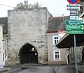 |
48°45′20″N 15°57′06″E / 48.7556111°N 15.9515556°E | |
| 2 | Q37797242 | Stadttor, Eisernes Tor | city gate | Hardegg | 48°51′08″N 15°51′11″E / 48.8521944°N 15.853056°E | ||||
| 3 | Q217970 | Znaimertor | building in Lower Austria, Austria | city gate | Retz | Retz Stadt Stadttor Znaimertor |  |
48°45′29″N 15°57′07″E / 48.75813°N 15.95181°E |
clergy house
[edit]
column shrine
[edit]
concentration camp
[edit]
crucifix
[edit]| # | WD item | article | description | is a | municipality | commons category | picture | coordinates | position map |
|---|---|---|---|---|---|---|---|---|---|
| 1 | Q37805578 | Kruzifix | crucifix | Haugsdorf | Kruzifix (Haugsdorf, ObjektID: 12252) |  |
48°44′34″N 16°04′51″E / 48.7428°N 16.0808°E | ||
| 2 | Q37794989 | Wegkreuz | crucifix | Hadres |  |
48°41′13″N 16°09′11″E / 48.68692°N 16.15315°E | |||
| 3 | Q37832923 | Wegkreuz | crucifix | Ravelsbach |  |
48°33′29″N 15°52′24″E / 48.55812°N 15.8733°E | |||
| 4 | Q37844284 | Wegkreuz | crucifix | Retzbach | Wegkreuz (Unterretzbach, Vergessener Herrgott, ObjektID: 1461) |  |
48°45′16″N 16°01′16″E / 48.7543056°N 16.021111°E | ||
| 5 | Q37898619 | Weißes Kreuz | crucifix | Zellerndorf |  |
48°41′59″N 15°55′05″E / 48.69978°N 15.9181°E |
cultural property
[edit]
cup marked stones
[edit]| # | WD item | article | description | is a | municipality | commons category | picture | coordinates | position map |
|---|---|---|---|---|---|---|---|---|---|
| 1 | Q108546803 | Heiliger Stein ("Holy stone") | Cup-marked stone in Mitterretzbach, Lower Austria | cup marked stones | Retzbach | NÖ-Naturdenkmal HL-057 Heiliger Stein oder Schalenstein |  |
48°47′30″N 15°58′15″E / 48.79152778°N 15.97083333°E | |
| 2 | Q1722162 | Leodagger Kalenderstein | Cup-marked stone in Pulkau, Lower Austria | cup marked stones | Pulkau | Leodagger Kalenderstein |  |
48°43′12″N 15°51′36″E / 48.72°N 15.8601°E |
estate
[edit]| # | WD item | article | description | is a | municipality | commons category | picture | coordinates | position map |
|---|---|---|---|---|---|---|---|---|---|
| 1 | Q37884323 | Ehemaliger Gutshof der Retzer Dominikaner | estate | Retz |  |
48°44′30″N 15°57′26″E / 48.74175°N 15.9572778°E | |||
| 2 | Q22920286 | Gottelhof | estate | Wullersdorf | 48°39′55″N 16°07′05″E / 48.66527778°N 16.11805556°E | ||||
| 3 | Q28800330 | Nexenhof | estate | Wullersdorf | 48°37′02″N 16°04′20″E / 48.617221944444445°N 16.072221944444443°E |
farm
[edit]
farm building
[edit]| # | WD item | article | description | is a | municipality | commons category | picture | coordinates | position map |
|---|---|---|---|---|---|---|---|---|---|
| 1 | Q37813348 | Unterdürnbach Wirtschaftshof | farm building | Maissau | Unterdürnbach Wirtschaftshof |  |
48°34′35″N 15°52′27″E / 48.57652°N 15.87406°E | ||
| 2 | Q37819965 | ehemaliger herrschaftlicher Wirtschaftsbau | farm building | Sitzendorf an der Schmida |  |
48°35′56″N 15°56′38″E / 48.59886°N 15.94384°E |
fire station
[edit]
forest
[edit]| # | WD item | article | description | is a | municipality | commons category | picture | coordinates | position map |
|---|---|---|---|---|---|---|---|---|---|
| 1 | Q21875747 | Gemeinholz | forest | Grabern | 48°34′55″N 16°01′46″E / 48.581944444444446°N 16.029444444444444°E | ||||
| 2 | Q21875782 | Grainholz | forest in Lower Austria | forest | Ziersdorf | 48°32′46″N 16°00′12″E / 48.54611111111111°N 16.003333333333334°E | |||
| 3 | Q21875748 | Karholz | forest | Grabern | 48°35′31″N 16°01′40″E / 48.59194444444445°N 16.02777777777778°E | ||||
| 4 | Q21861953 | Kirchenwald | forest in Lower Austria in the municipality of Hardegg right of river Thaya | forest | Hardegg | 48°49′11″N 15°56′51″E / 48.81966°N 15.94747°E | |||
| 5 | Q21875547 | Locatelliwald | forest | Hadres | 48°40′25″N 16°07′02″E / 48.673611111111114°N 16.11722222222222°E | ||||
| 6 | Q21875754 | Maiholz | forest | Grabern | 48°35′51″N 15°59′30″E / 48.5975°N 15.991666666666667°E | ||||
| 7 | Q21863177 | Spittlmais | forest in Austria | forest | Hardegg | 48°47′03″N 15°56′31″E / 48.784166666666664°N 15.941944444444443°E |
granary
[edit]| # | WD item | article | description | is a | municipality | commons category | picture | coordinates | position map |
|---|---|---|---|---|---|---|---|---|---|
| 1 | Q112943327 | Granary Kirchengasse 2 | Listed object in Guntersdorf, Austria | granary | Guntersdorf | 48°39′05″N 16°03′02″E / 48.65147°N 16.05059°E | |||
| 2 | Q37883956 | Granary in Wullersdorf | granary | Wullersdorf | Schüttkasten in Wullersdorf |  |
48°37′33″N 16°06′09″E / 48.62592°N 16.10258°E | ||
| 3 | Q37887108 | Retz Altstadt Schüttkasten | granary | Retz | Retz Altstadt Schüttkasten |  |
48°45′32″N 15°57′16″E / 48.7589167°N 15.9543333°E | ||
| 4 | Q37790269 | Schüttkasten Guntersdorf | granary | Guntersdorf | Schüttkasten Guntersdorf |  |
48°38′50″N 16°02′50″E / 48.6471389°N 16.0473056°E | ||
| 5 | Q37805173 | Schüttkasten Haugsdorf | granary | Haugsdorf | Schüttkasten Haugsdorf |  |
48°42′20″N 16°04′51″E / 48.70562°N 16.08087°E | ||
| 6 | Q37819854 | ehemaliger Schüttkasten | granary | Sitzendorf an der Schmida |  |
48°36′06″N 15°56′53″E / 48.60171°N 15.94797°E |
hill
[edit]| # | WD item | article | description | is a | municipality | commons category | picture | coordinates | position map |
|---|---|---|---|---|---|---|---|---|---|
| 1 | Q21868598 | Köhlberg | hill in Austria | hill | Ziersdorf | 48°32′22″N 15°57′11″E / 48.53944°N 15.95306°E | |||
| 2 | Q21861943 | Mitterberg | hill in Hollabrunn, Lower Austria | hill | Hollabrunn District | 48°46′01″N 15°56′40″E / 48.766938888889°N 15.944438888889°E | |||
| 3 | Q21875692 | Mitterberg | Mountain in Hollabrunn, Lower Austria | hill | Hollabrunn District | 48°42′01″N 15°55′54″E / 48.700280555556°N 15.931669444444°E |
hospital
[edit]| # | WD item | article | description | is a | municipality | commons category | picture | coordinates | position map |
|---|---|---|---|---|---|---|---|---|---|
| 1 | Q37895683 | Hollabrunn Armenhaus | hospital in Austria | hospital former hospital |
Hollabrunn | Hollabrunn Armenhaus (Amtsgasse) | 48°33′44″N 16°04′51″E / 48.56232°N 16.08081°E | ||
| 2 | Q1436774 | Landesklinikum Hollabrunn | hospital in Austria | hospital | Hollabrunn |  |
48°33′47″N 16°05′28″E / 48.5631°N 16.0911°E | ||
| 3 | Q37820033 | ehemaliges Waisen- und Krankenhaus | hospital in Austria | hospital former hospital |
Sitzendorf an der Schmida |  |
48°35′52″N 15°56′30″E / 48.59772°N 15.94166°E |
hotel
[edit]| # | WD item | article | description | is a | municipality | commons category | picture | coordinates | position map |
|---|---|---|---|---|---|---|---|---|---|
| 1 | Q112015185 | Amethysthotel Mantler | hotel in Austria | hotel | Maissau | 48°34′31″N 15°49′22″E / 48.5753°N 15.8227°E | |||
| 2 | Q111876263 | Hotel Althof Retz | hotel in Retz, Austria | hotel | Retz | 48°45′28″N 15°57′02″E / 48.75791°N 15.95042°E | |||
| 3 | Q112015333 | Jufa Hotel Weinviertel | hotel in Austria | hotel | Seefeld-Kadolz | 48°42′52″N 16°10′26″E / 48.71445°N 16.17384°E |
human settlement
[edit]
location of discovery
[edit]
market municipality
[edit]
mill
[edit]
monastery
[edit]| # | WD item | article | description | is a | municipality | commons category | picture | coordinates | position map |
|---|---|---|---|---|---|---|---|---|---|
| 1 | Q104915725 | Priorat St. Josef | monastery | Wullersdorf | 48°37′07″N 16°08′11″E / 48.618632°N 16.136459°E | ||||
| 2 | Q37865131 | Retz Stadt Dominikanerkloster mit Kirche Maria Himmelfahrt | building in Retz, Austria | monastery | Retz | Retz Stadt Dominikanerkloster mit Kirche Maria Himmelfahrt |  |
48°45′23″N 15°56′55″E / 48.756389°N 15.9487222°E |
monument
[edit]
motte-and-bailey castle
[edit]| # | WD item | article | description | is a | municipality | commons category | picture | coordinates | position map |
|---|---|---|---|---|---|---|---|---|---|
| 1 | Q38001742 | Hausberg Eitzersthal | motte-and-bailey castle | Göllersdorf | Hausberg Eitzersthal |  |
48°29′15″N 16°06′05″E / 48.4875°N 16.1013°E | ||
| 2 | Q37924485 | Hausberg Guglerberg | motte-and-bailey castle | Mailberg | 48°41′57″N 16°12′30″E / 48.69905°N 16.2082°E |
mountain
[edit]
municipal archive
[edit]| # | WD item | article | description | is a | municipality | commons category | picture | coordinates | position map |
|---|---|---|---|---|---|---|---|---|---|
| 1 | Q132559763 | Stadtarchiv Hollabrunn | municipal archive | Hollabrunn | |||||
| 2 | Q132857915 | Stadtarchiv Retz | municipal archive | Retz |
municipality of Austria
[edit]
municipality seat
[edit]
museum
[edit]
nature reserve
[edit]| # | WD item | article | description | is a | municipality | commons category | picture | coordinates | position map |
|---|---|---|---|---|---|---|---|---|---|
| 1 | Q15836412 | Mühlberg | nature reserve in Sitzendorf an der Schmida, Lower Austria, Austria | nature reserve | Sitzendorf an der Schmida | Mühlberg (Goggendorf) | 48°37′30″N 15°56′21″E / 48.62491667°N 15.93916667°E | ||
| 2 | Q108143549 | Schleinitzbachniederung | nature reserve in Lower Austria | nature reserve | Maissau | Naturschutzgebiet Schleinitzbachniederungen |  |
48°34′49″N 15°46′26″E / 48.580278°N 15.774°E | |
| 3 | Q108060514 | Thayatal | nature reserve in Lower Austria | nature reserve | Hardegg |  |
48°50′24″N 15°52′54″E / 48.84012°N 15.88178°E |
observation tower
[edit]| # | WD item | article | description | is a | municipality | commons category | picture | coordinates | position map |
|---|---|---|---|---|---|---|---|---|---|
| 1 | Q21875686 | Europawarte | mountain in Austria | observation tower | Schrattenthal |  |
48°44′50″N 15°51′59″E / 48.74722222222222°N 15.866388888888888°E | ||
| 2 | Q26834286 | Heidbergwarte | observation tower | Alberndorf im Pulkautal | 48°44′34″N 16°05′52″E / 48.742778°N 16.097778°E | ||||
| 3 | Q104536409 | Koliskowarte | Observation tower near Hollabrunn, Austria | observation tower | Hollabrunn | Koliskowarte |  |
48°33′05″N 16°06′29″E / 48.55151°N 16.10803°E |
ossuary
[edit]| # | WD item | article | description | is a | municipality | commons category | picture | coordinates | position map |
|---|---|---|---|---|---|---|---|---|---|
| 1 | Q1734101 | Hardegg Karner | church building in Hardegg, Austria | ossuary rotunda chapel |
Hardegg | Karner Hardegg |  |
48°51′16″N 15°51′29″E / 48.8545°N 15.85802°E | |
| 2 | Q37845531 | Karner Zellerndorf | Listed monument in Zellerndorf, Lower Austria | ossuary | Zellerndorf | Karner Zellerndorf |  |
48°42′02″N 15°57′23″E / 48.70043°N 15.95634°E | |
| 3 | Q37861178 | Karner in Wullersdorf | building in Wullersdorf, Austria | ossuary | Wullersdorf | Karner in Wullersdorf | 48°37′37″N 16°06′12″E / 48.62689°N 16.10322°E | ||
| 4 | Q37879794 | Pulkau Karner | ossuary | Pulkau | Karner Pulkau |  |
48°42′28″N 15°51′40″E / 48.70782°N 15.86118°E |
parish church
[edit]
pier
[edit]| # | WD item | article | description | is a | municipality | commons category | picture | coordinates | position map |
|---|---|---|---|---|---|---|---|---|---|
| 1 | Q37879563 | Pulkau ehem. Markttor | pier city gate |
Pulkau | Pulkau ehem. Markttor | 48°42′10″N 15°51′32″E / 48.7028°N 15.85895°E | |||
| 2 | Q37879651 | Reste eines Tores | pier city gate |
Pulkau |  |
48°42′14″N 15°51′53″E / 48.70389°N 15.86486°E |
pipe organ
[edit]| # | WD item | article | description | is a | municipality | commons category | picture | coordinates | position map |
|---|---|---|---|---|---|---|---|---|---|
| 1 | Q112730760 | Orgel der röm. kath. Pfarrkirche "Maria Himmelfahrt und St. Benedikt" | pipe organ | pipe organ | Haugsdorf | 48°42′20″N 16°03′22″E / 48.705645°N 16.056023°E | |||
| 2 | Q112754009 | Orgel der röm.-kath. Pfarrkirche St. Andreas - Göllersdorf | pipe organ | pipe organ | Göllersdorf | 48°30′18″N 16°06′24″E / 48.504944°N 16.106778°E |
place designated by a field name
[edit]| # | WD item | article | description | is a | municipality | commons category | picture | coordinates | position map |
|---|---|---|---|---|---|---|---|---|---|
| 1 | Q21875626 | Brandsberg | local name in Lower Austria | place designated by a field name | Hollabrunn | 48°35′50″N 16°06′57″E / 48.597222222222°N 16.115833333333°E | |||
| 2 | Q21871267 | In den Großen Atlesbergen | field name in Lower Austria | place designated by a field name | Mailberg | 48°40′33″N 16°11′50″E / 48.67583333333333°N 16.197222222222223°E | |||
| 3 | Q21861913 | Lienerberg | field name in the Waldviertel in Lower Austria | place designated by a field name | Hardegg | 48°49′10″N 15°48′44″E / 48.81944444444444°N 15.812222222222225°E | |||
| 4 | Q21875607 | Wolfstal | place designated by a field name | Hollabrunn | 48°35′33″N 16°12′39″E / 48.5925°N 16.210833333333°E |
portal
[edit]| # | WD item | article | description | is a | municipality | commons category | picture | coordinates | position map |
|---|---|---|---|---|---|---|---|---|---|
| 1 | Q37785589 | Alberndorf im Pulkautal Friedhofsportal | cemetery portal in Alberndorf im Pulkautal, Austria | portal | Alberndorf im Pulkautal | Alberndorf im Pulkautal Friedhofsportal |  |
48°41′51″N 16°06′01″E / 48.6973889°N 16.1001667°E | |
| 2 | Q37806539 | Friedhofsportal | cemetery in Heldenberg, Austria | portal | Heldenberg |  |
48°30′30″N 15°56′21″E / 48.50832°N 15.93926°E | ||
| 3 | Q37844610 | Friedhofsportal Obermarkersdorf | cemetery in Schrattenthal, Austria | portal | Schrattenthal | Friedhofsportal Obermarkersdorf |  |
48°44′20″N 15°53′57″E / 48.73884°N 15.89926°E | |
| 4 | Q37788387 | Göllersdorf Schlosstor – Triumphtor | portal | Göllersdorf | Göllersdorf Schlosstor – Triumphtor | 48°29′37″N 16°07′12″E / 48.4937222°N 16.1199444°E | |||
| 5 | Q37887003 | garden portal in Retz | portal | Retz | Retz Stadt Gartenportal (Ignazigasse) |  |
48°45′27″N 15°56′57″E / 48.7576°N 15.94929°E |
public library
[edit]
railway station
[edit]
railway stop
[edit]| # | WD item | article | description | is a | municipality | commons category | picture | coordinates | position map |
|---|---|---|---|---|---|---|---|---|---|
| 1 | Q83008146 | Bahnhof Unter Retzbach | railway stop in Retzbach, Austria | railway stop | Retzbach | Bahnhof Unter Retzbach |  |
48°45′54″N 16°00′29″E / 48.76511°N 16.008050833333332°E | |
| 2 | Q100733676 | Breitenwaida halt | railway halt in Lower Austria | railway stop | Hollabrunn | Bahnhof Breitenwaida |  |
48°30′54″N 16°04′29″E / 48.514913°N 16.074761°E | |
| 3 | Q99337544 | Glaubendorf-Wetzdorf halt | railway halt in Austria | railway stop | Heldenberg | Bahnhof Glaubendorf-Wetzdorf |  |
48°30′16″N 15°56′37″E / 48.504444444444445°N 15.94361111111111°E | |
| 4 | Q99337546 | Ravelsbach halt | railway halt in Austria | railway stop | Ravelsbach | Bahnhof Ravelsbach |  |
48°33′21″N 15°53′12″E / 48.55596°N 15.88678°E | |
| 5 | Q100733698 | Schönborn-Mallebarn halt | railway halt in Lower Austria | railway stop | Göllersdorf | Bahnhof Schönborn-Mallebern |  |
48°28′07″N 16°09′33″E / 48.46855°N 16.15912°E |
relief sculpture
[edit]| # | WD item | article | description | is a | municipality | commons category | picture | coordinates | position map |
|---|---|---|---|---|---|---|---|---|---|
| 1 | Q105640691 | Relief Dreifaltigkeit mit Maria | relief sculpture | Retz |  |
48°45′26″N 15°57′01″E / 48.75731°N 15.95022°E | |||
| 2 | Q1486115 | Steinerne Bibel | relief sculpture | Grabern | Pfarrkirche Schöngrabern | 48°36′08″N 16°03′53″E / 48.6021°N 16.0648°E |
residential building
[edit]
rock
[edit]| # | WD item | article | description | is a | municipality | commons category | picture | coordinates | position map |
|---|---|---|---|---|---|---|---|---|---|
| 1 | Q105203306 | NÖ-Naturdenkmal HL-061 Hangenstein | natural monument in Retz, Lower Austria | rock | Retz | NÖ-Naturdenkmal HL-061 Hangenstein |  |
48°45′02″N 15°55′02″E / 48.750589°N 15.917269°E | |
| 2 | Q111594730 | Zanitzerstein | Rock near Schrattenthal, Lower Austria | rock | Schrattenthal | NÖ-Naturdenkmal HL-070 Zanitzerstein und Umgebungsbereich |  |
48°42′40″N 15°54′45″E / 48.71111°N 15.91258°E |
rural municipality of Austria
[edit]| # | WD item | article | description | is a | municipality | commons category | picture | coordinates | position map |
|---|---|---|---|---|---|---|---|---|---|
| 1 | Q676971 | Alberndorf im Pulkautal | municipality in Hollabrunn District, Lower Austria, Austria | rural municipality of Austria municipality of Austria |
Hollabrunn District | Alberndorf im Pulkautal |  |
48°42′20″N 16°06′05″E / 48.705555555556°N 16.101388888889°E |  |
| 2 | Q676890 | Heldenberg | municipality in Hollabrunn District, Lower Austria, Austria | rural municipality of Austria municipality of Austria |
Hollabrunn District | Heldenberg |  |
48°30′N 15°57′E / 48.5°N 15.95°E | |
| 3 | Q667813 | Retzbach | municipality in Hollabrunn District, Lower Austria, Austria | rural municipality of Austria municipality of Austria |
Hollabrunn District | Retzbach (Niederösterreich) |  |
48°46′00″N 15°59′00″E / 48.766666666667°N 15.983333333333°E |
school building
[edit]
sculpture
[edit]
sepulchral monument
[edit]| # | WD item | article | description | is a | municipality | commons category | picture | coordinates | position map |
|---|---|---|---|---|---|---|---|---|---|
| 1 | Q37798445 | Niederfladnitz Grabdenkmäler | sepulchral monument | Hardegg | Niederfladnitz Grabdenkmäler | 48°47′43″N 15°53′56″E / 48.79525°N 15.8988333°E | |||
| 2 | Q37813421 | Unterdürnbach Grabdenkmäler | sepulchral monument | Maissau | Unterdürnbach Grabdenkmäler |  |
48°34′48″N 15°52′22″E / 48.57994°N 15.87276°E |
spring
[edit]| # | WD item | article | description | is a | municipality | commons category | picture | coordinates | position map |
|---|---|---|---|---|---|---|---|---|---|
| 1 | Q21875685 | Heidbründl | spring in Lower Austria | spring | Pulkau | 48°43′19″N 15°50′21″E / 48.721944444444446°N 15.839166666666667°E | |||
| 2 | Q21875780 | Marienbründl | spring in Lower Austria (municipality of Hollabrunn) | spring | Hollabrunn | 48°34′18″N 16°00′44″E / 48.571666666666665°N 16.01222222222222°E |
station building
[edit]| # | WD item | article | description | is a | municipality | commons category | picture | coordinates | position map |
|---|---|---|---|---|---|---|---|---|---|
| 1 | Q37898740 | Aufnahmsgebäude Bahnhof Zellerndorf | station building in Zellerndorf, Austria | station building | Zellerndorf | Aufnahmsgebäude Bahnhof Zellerndorf |  |
48°41′44″N 15°58′06″E / 48.69552°N 15.9684°E | |
| 2 | Q37872204 | Aufnahmsgebäude Unterretzbach, Eisenbahnmuseum | building in Retz, Austria | station building | Retz | Güterbahnhof Unter Retzbach |  |
48°45′28″N 16°00′11″E / 48.757778°N 16.0029444°E | |
| 3 | Q37848250 | Station building Retz | station building in Retz, Austria | station building | Retz | Aufnahmsgebäude Bahnhof Retz |  |
48°45′14″N 15°57′25″E / 48.75375°N 15.9569167°E |
stone cross
[edit]| # | WD item | article | description | is a | municipality | commons category | picture | coordinates | position map |
|---|---|---|---|---|---|---|---|---|---|
| 1 | Q37879738 | Grabdenkmal /Epitaph, Steinkreuze | stone cross | Pulkau |  |
48°42′29″N 15°51′38″E / 48.70814°N 15.86049°E | |||
| 2 | Q37879753 | Steinkreuze | stone cross | Pulkau |  |
48°42′29″N 15°51′39″E / 48.70792°N 15.86074°E |
tombstone
[edit]
valley
[edit]| # | WD item | article | description | is a | municipality | commons category | picture | coordinates | position map |
|---|---|---|---|---|---|---|---|---|---|
| 1 | Q21861930 | Edinental | valley in Lower Austria, Austria | valley | Hardegg | 48°50′47″N 15°49′59″E / 48.84638888888889°N 15.833055555555555°E | |||
| 2 | Q21875767 | Gänsgraben | valley of Schleinitz in Lower Austria | valley | Burgschleinitz-Kühnring Maissau |
48°35′55″N 15°50′45″E / 48.598611111111°N 15.845833333333°E | |||
| 3 | Q21861918 | Pleissinger Tal | valley of Riegersburger Bach in Lower Austria | valley | Hardegg | 48°50′04″N 15°47′49″E / 48.83444444444444°N 15.796944444444444°E | |||
| 4 | Q21861922 | Rosental | valley of Fugnitz in Lower Austria | valley | Hardegg | 48°49′53″N 15°49′09″E / 48.83138888888889°N 15.819166666666666°E | |||
| 5 | Q21875736 | Verlorenes Tal | valley in Lower Austria, Austria | valley | Sitzendorf an der Schmida | 48°37′55″N 15°56′35″E / 48.631944444444°N 15.943055555556°E |
war memorial
[edit]| # | WD item | article | description | is a | municipality | commons category | picture | coordinates | position map |
|---|---|---|---|---|---|---|---|---|---|
| 1 | Q37787323 | Hollabrunn column | war memorial | Grabern | Hollabrunn column |  |
48°35′33″N 16°03′56″E / 48.5924722°N 16.0656944°E | ||
| 2 | Q37805271 | Kriegerdenkmal | war memorial | Haugsdorf | Kriegerdenkmal (Haugsdorf, Laaer Straße, ObjektID: 12235) | 48°42′20″N 16°04′46″E / 48.70565°N 16.07937°E | |||
| 3 | Q1453216 | Kriegerdenkmal 1809 | war memorial in Retz to the victims of the battle of Wagram | war memorial | Retz | Kriegerdenkmal 1809, Retz |  |
48°45′19″N 15°57′15″E / 48.7553°N 15.9541°E | |
| 4 | Q37868839 | Russendenkmal | war memorial | Hollabrunn | Russendenkmal (Hollabrunn, ObjektID: 18659) | 48°33′15″N 16°05′06″E / 48.55411°N 16.08497°E |
water well
[edit]
watercourse
[edit]
wayside cross
[edit]
wayside shrine
[edit]
whipping post
[edit]
windmill
[edit]| # | WD item | article | description | is a | municipality | commons category | picture | coordinates | position map |
|---|---|---|---|---|---|---|---|---|---|
| 1 | Q107552291 | Former windmill | Listed object in Retz, Lower Austria | windmill residential building |
Retz | Zweite (ehemalige) Windmühle, Retz |  |
Template:Coord | |
| 2 | Q1644406 | Retz Altstadt Windmühle | Windmill in Retz, Lower Austria | windmill museum |
Retz | Retz Altstadt Windmühle |  |
Template:Coord |


