Piherarh
Appearance
Piherarh | |
|---|---|
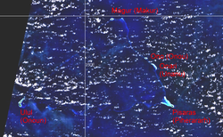
 NASA WorldWind screenshot of Namonuito Atoll showing Piherarh's location | |
 | |
| Country | Federated States of Micronesia |
| State | Chuuk State |
| Area | |
| • Land | 0.5 km2 (0.2 sq mi) |
| Population (2010) | |
• Total | 227 |
| Time zone | UTC+10 |
Piherarh,[1] also known as Pisaras, is the easternmost island of Namonuito Atoll and a municipality in the state of Chuuk, Federated States of Micronesia.[2] Islets within the municipality include Wabonoru, Pielimal and Weltot.
References
[edit]- ^ Article 13, Section 2, Constitution of Chuuk State, 7 June 2025 – via Legal Information System of the Federated States of Micronesia
- ^ Statoids.com, retrieved December 8, 2010
