
Panola Township, Woodford County, Illinois
Panola Township | |
|---|---|
Township | |
 Location in Woodford County | |
| Country | United States |
| State | Illinois |
| County | Woodford |
| Established | November 7, 1854[1] |
| Area | |
• Total | 36.48 sq mi (94.5 km2) |
| • Land | 36.44 sq mi (94.4 km2) |
| • Water | 0.03 sq mi (0.08 km2) 0.08% |
| Population (2020) | |
• Estimate (2020)[2] | 375 |
| • Density | 9.7/sq mi (3.7/km2) |
| Time zone | UTC-6 (CST) |
| • Summer (DST) | UTC-5 (CDT) |
| FIPS code | 17-203-57537 |
Panola Township is located in Woodford County, Illinois at T27N, R2E. As of the 2020 census, its population was 375, and it contained 144 housing units.[3] Panola Township and Minonk Township (T28N, R2E) were originally the same township, but formed two new townships on an unknown date.[4]
Geography
[edit]According to the 2010 census, the township has a total area of 36.48 square miles (94.5 km2), of which 36.44 square miles (94.4 km2) (or 99.89%) is land and 0.03 square miles (0.078 km2) (or 0.08%) is water.[3]
Demographics
[edit]| Census | Pop. | Note | %± |
|---|---|---|---|
| 2000 | 356 | — | |
| 2010 | 353 | −0.8% | |
| 2020 | 375 | 6.2% | |
| U.S. Decennial Census[5] | |||
| Racial-ethnic composition | 2020[2] | 2010[6] | 2000[7] |
|---|---|---|---|
| White (Non-Hispanic) | 94.1% | 95.8% | |
| Black or African American | 0.27% | 2.9% | |
| Asian | 0% | 0.3% | |
| Other | 1.3% | 0% |
References
[edit]- ^ "Name Index to Illinois Local Governments". ilsos.gov. Retrieved April 11, 2025.
- ^ a b "2020 Explore Census Data". data.census.gov. Retrieved April 11, 2025.
- ^ a b "Population, Housing Units, Area, and Density: 2010 - County -- County Subdivision and Place -- 2010 Census Summary File 1". United States Census. Archived from the original on February 12, 2020. Retrieved May 28, 2013.
- ^ "Illinois Regional Archives Depository (IRAD) System". ilsos.gov. Retrieved April 11, 2025.
- ^ "Census of Population and Housing". Census.gov. Retrieved June 4, 2016.
- ^ "2010 Explore Census Data". data.census.gov. Retrieved April 11, 2025.
- ^ "2000 Explore Census Data". data.census.gov. Retrieved April 11, 2025.
External links
[edit]Municipalities and communities of Woodford County, Illinois, United States | ||
|---|---|---|
| Cities | 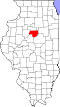 | |
| Villages | ||
| Townships | ||
| CDP | ||
| Other communities | ||
40°48′N 89°0′W / 40.800°N 89.000°W
This Woodford County, Illinois location article is a stub. You can help Wikipedia by expanding it. |