
Nižná Polianka
Nižná Polianka | |
|---|---|
 Nižná Polianka from the route to border with Poland | |
 Flag  Coat of arms | |
 Nižná Polianka Location of Nižná Polianka in the Prešov Region  Nižná Polianka Location of Nižná Polianka in Slovakia | |
| Coordinates: 49°24′N 21°24′E / 49.40°N 21.40°E | |
| Country | |
| Region | |
| District | Bardejov District |
| First mentioned | 1435 |
| Area | |
• Total | 5.88 km2 (2.27 sq mi) |
| Elevation | 385 m (1,263 ft) |
| Population (2021)[3] | |
• Total | 224 |
| Time zone | UTC+1 (CET) |
| • Summer (DST) | UTC+2 (CEST) |
| Postal code | 863 6[2] |
| Area code | +421 54[2] |
| Car plate | BJ |
| Website | obecniznapolianka |
Nižná Polianka (Rusyn: Нижня Полянка; Hungarian: Alsópagony) is a village and municipality in Bardejov District in the Prešov Region of north-east Slovakia.
History
[edit]In historical records the village was first mentioned in 1435
Geography
[edit]The municipality lies at an altitude of 395 metres and covers an area of 5.876 km2. It has a population of about 252 people.
Gallery
[edit]-
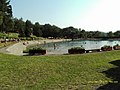 swimming pool
 -
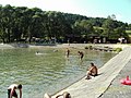 swimming pool
 -
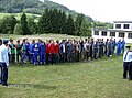 hasičská súťaž
 -
 hasičská súťaž
 -
 hasičská súťaž


References
[edit]- ^ "Hustota obyvateľstva - obce [om7014rr_ukaz: Rozloha (Štvorcový meter)]". www.statistics.sk (in Slovak). Statistical Office of the Slovak Republic. 2022-03-31. Retrieved 2022-03-31.
- ^ a b c "Základná charakteristika". www.statistics.sk (in Slovak). Statistical Office of the Slovak Republic. 2015-04-17. Retrieved 2022-03-31.
- ^ "Počet obyvateľov podľa pohlavia - obce (ročne)". www.statistics.sk (in Slovak). Statistical Office of the Slovak Republic. 2022-03-31. Retrieved 2022-03-31.
This Prešov Region geography article is a stub. You can help Wikipedia by expanding it. |