Mont Ngaoui
Appearance
| Mont Ngaoui | |
|---|---|
 Mont Ngaoui in 2022 | |
| Highest point | |
| Elevation | 1,410 m (4,630 ft) |
| Listing | Country high point |
| Coordinates | 6°45′05″N 14°57′35″E / 6.75139°N 14.95972°E |
| Geography | |
| Location | Central African Republic / Cameroon |
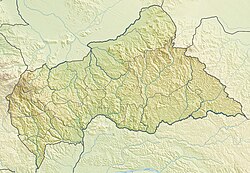
Mont Ngaoui is the highest mountain in the Central African Republic. It is located on the border with Cameroon and has a summit elevation of 1,410 metres (4,626 ft).[1][2]
References
[edit]- ^ Boulvert, Yves (September 2002). "Le Centrafrique au seuil du troisième millénaire Essai synthétique de géographie physique, économique et humaine. Bilan" (PDF). La Géographie (1506): 48.
La République centrafricaine s'étage entre 325 mètres à l'entrée de l'Oubangui en territoire congolais, et 1410 m au mont Ngaoui, sur la frontière camerounaise.
[The Central African Republic ranges from 325 meters at the entrance to Oubangui in Congolese territory, to 1410 m at Mount Ngaoui, on the Cameroonian border.] - ^ "Central African Republic § Elevation". The World Factbook (2025 ed.). Central Intelligence Agency.

