
Lutogniewice
Lutogniewice | |
|---|---|
Village | |
 Half-timbered house | |
 Lutogniewice | |
| Coordinates: 51°00′29″N 14°58′3″E / 51.00806°N 14.96750°E | |
| Country | |
| Voivodeship | Lower Silesian |
| County | Zgorzelec |
| Gmina | Bogatynia |
| Population | 218 |
Lutogniewice [lutɔɡɲɛˈvit͡sɛ] is a village in the administrative district of Gmina Bogatynia, within Zgorzelec County, Lower Silesian Voivodeship, in south-western Poland, close to the Czech and German borders.[1] It lies approximately 11 km (7 mi) north of Bogatynia, 17 km (11 mi) south of Zgorzelec, and 146 km (91 mi) west of the regional capital Wrocław.
Gallery
[edit]-
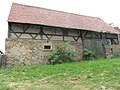 Barn
Barn -
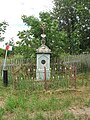 Wayside cross
 -
 Bus stop
.jpg)
.jpg)

References
[edit]- ^ "Główny Urząd Statystyczny" [Central Statistical Office] (in Polish). Select Miejscowości (SIMC) tab, select fragment (min. 3 znaki), enter town name in the field below, click WYSZUKAJ (Search)
Wikimedia Commons has media related to Lutogniewice.
| Town and seat |  | |
|---|---|---|
| Villages | ||
This Zgorzelec County location article is a stub. You can help Wikipedia by expanding it. |