
Kaludiya Pokuna Forest
| Kaludiya Pokuna Forest and Archeological Site | |
|---|---|
 View from Kandalama Hotel Side | |
 | |
| Location | Central Province, Sri Lanka |
| Nearest city | Dambulla |
| Coordinates | 7°52′02″N 80°44′01″E / 7.86722°N 80.73361°E |
| Governing body | Department of Archeology |
Kaludiya Pokuna Archeological Forest Site (කළුදිය පොකුණ පුරාවිද්යා භූමිය) is a forest with archeological remains in Kandalama, in the Dry Zone of Sri Lanka.[1][2][3]
Etymology
[edit]The term Kaludiya Pokuna (කළුදිය පොකුණ) means black water pond or black water pool in the Sinhalese language. [4]
Archeological remains
[edit]Kaludiya Pokuna was settled in the 2nd century BC as a monastery complex. This archaeological site features the remains of an uposathaghara building used for monks rituals, a cankamana path, parivena residential cells, bathhouses, and lavatories.[5]
Gallery
[edit]-
 Pagoda at Kaludiya Pokuna
 -
 Former monasteries at Kuladiya Pokuna
 -
 Stairs to main site at Kuladiya Pokuna
 -
 Medieval Sinhala inscription slab at Kaludiya Pokuna
 -
 Pagoda at Kaludiya Pokuna
 -
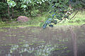 Black pond at Kaludiya pokuna


References
[edit]- ^ Rajnish P. Vandercone, Chameera Dinadh, Gayan Wijethunga, Kitsiri Ranawana, David T. Rasmussen (December 2012). Dietary Diversity and Food Selection in Hanuman Langurs (Semnopithecus entellus) and Purple-Faced Langurs (Trachypithecus vetulus) in the Kaludiyapokuna Forest Reserve in the Dry Zone of Sri Lanka. International Journal of Primatology 33 (6): 1382-1405.
- ^ "Kaludiya Pokuna handed over to Kandy High School". Lankadeepa. Retrieved 27 April 2021.
- ^ "Kaludiya Pokuna under Kandy High School". hirunews. Retrieved 27 April 2021.
- ^ "Kaludiya Pokuna of Mihintale | AmazingLanka.com". AmazingLanka.com.
- ^ Seneviratna, Anuradha (1993). Mihintale. Sri Lanka: Associated Newspapers of Ceylon. p. 45. ISBN 978-955-9034-06-3.
External links
[edit]- Kaludiya Pokuna[permanent dead link] at the website of the Department of Archaeology of the Sri Lanka government
- Green Pradise' of Kandalama, The Sunday Times Sri Lanka