
Hooper, Colorado
Hooper, Colorado | |
|---|---|
| Town of Hooper[1] | |
| Motto(s): File:Alamosa County Colorado Incorporated and Unincorporated areas Hooper Highlighted 0837380.svg | |
 Hooper Location of the Town of Hooper in the United States. | |
| Coordinates: 37°44′45″N 105°52′37″W / 37.74583°N 105.87694°W | |
| Country | |
| State | |
| County | Alamosa County |
| Incorporated (town) | May 20, 1898[2] |
| Government | |
| • Type | Statutory Town[1] |
| Area | |
• Total | 0.25 sq mi (0.65 km2) |
| • Land | 0.25 sq mi (0.65 km2) |
| • Water | 0.00 sq mi (0.00 km2) |
| Elevation | 7,559 ft (2,304 m) |
| Population | |
• Total | 81 |
| • Density | 320/sq mi (120/km2) |
| Time zone | UTC-7 (MST) |
| • Summer (DST) | UTC-6 (MDT) |
| ZIP code[6] | 81136 |
| Area code | 719 |
| FIPS code | 08-37380 |
| GNIS feature ID | 2412766[4] |
The Town of Hooper is a Statutory Town located in the San Luis Valley in Alamosa County, Colorado, United States. The population was 81 at the 2020 census.[5]
Geography
[edit]According to the United States Census Bureau, the town has a total area of 0.27 square miles (0.7 km2), all of it land.[7]
Nearby points of interest include the Great Sand Dunes National Park and the town of Crestone.
History
[edit]
The post office at Hooper was known as Garrison from January 26, 1891, until July 17, 1896.[8] The present name honors Major S. Hooper, a railroad official.[9] Hooper was in Costilla County, Colorado until March 8, 1913, when the formation of Alamosa County was authorized by the state legislature.[10]
Demographics
[edit]| Census | Pop. | Note | %± |
|---|---|---|---|
| 1900 | 177 | — | |
| 1910 | 131 | −26.0% | |
| 1920 | 156 | 19.1% | |
| 1930 | 155 | −0.6% | |
| 1940 | 170 | 9.7% | |
| 1950 | 103 | −39.4% | |
| 1960 | 58 | −43.7% | |
| 1970 | 80 | 37.9% | |
| 1980 | 71 | −11.2% | |
| 1990 | 112 | 57.7% | |
| 2000 | 123 | 9.8% | |
| 2010 | 103 | −16.3% | |
| 2020 | 81 | −21.4% |
See also
[edit]References
[edit]- ^ a b c "Active Colorado Municipalities". Colorado Department of Local Affairs. Retrieved December 28, 2021.
- ^ "Colorado Municipal Incorporations". State of Colorado, Department of Personnel & Administration, Colorado State Archives. December 1, 2004. Archived from the original on September 27, 2007. Retrieved September 2, 2007.
- ^ "2019 U.S. Gazetteer Files". United States Census Bureau. Retrieved July 1, 2020.
- ^ a b U.S. Geological Survey Geographic Names Information System: Hooper, Colorado
- ^ a b United States Census Bureau. "Hooper town, Colorado". Retrieved April 2, 2023.
- ^ "ZIP Code Lookup". United States Postal Service. Archived from the original (JavaScript/HTML) on November 4, 2010. Retrieved October 6, 2007.
- ^ "Geographic Identifiers: 2010 Demographic Profile Data (G001): Hooper town, Colorado". U.S. Census Bureau, American Factfinder. Archived from the original on February 12, 2020. Retrieved May 3, 2013.
- ^ Page 60, Bauer, William H.; Ozment, James L.; and Willard, John H., Colorado Post Offices, 1859-1989: A Comprehensive Listing of Post Offices, Stations, and Branches, Colorado Railroad Museum (May 1990), hardcover, 280 pages, ISBN 978-0-918654-42-7
- ^ Dawson, John Frank. Place names in Colorado: why 700 communities were so named, 150 of Spanish or Indian origin. Denver, CO: The J. Frank Dawson Publishing Co. p. 27.
- ^ Page 242, Bauer, William H.; Ozment, James L.; and Willard, John H., Colorado Post Offices, 1859-1989: A Comprehensive Listing of Post Offices, Stations, and Branches, Colorado Railroad Museum (May 1990), hardcover, 280 pages, ISBN 978-0-918654-42-7
Further reading
[edit]Melvin McAllister, Life in Hooper, Colorado, self-published (1998), 211 pages OCLC 43887168
External links
[edit] Media related to Hooper, Colorado at Wikimedia Commons
- Town of Hooper contacts
- May 2006 Photos of Hooper, Colorado
Municipalities and communities of Alamosa County, Colorado, United States | ||
|---|---|---|
| City | 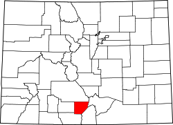 | |
| Town | ||
| CDP | ||
| Unincorporated communities | ||
| Footnotes | ‡This populated place also has portions in an adjacent county or counties | |