
Hilmar-Irwin, California
Hilmar-Irwin, California | |
|---|---|
 Location in Merced County, California | |
 Hilmar-Irwin Location in the United States | |
| Coordinates: 37°24′30″N 120°51′03″W / 37.40833°N 120.85083°W | |
| Country | |
| State | |
| County | Merced |
| Area | |
• Total | 3.928 sq mi (10.173 km2) |
| • Land | 3.928 sq mi (10.173 km2) |
| • Water | 0 sq mi (0 km2) 0% |
| Population (2020)[2] | |
• Total | 5,164 |
| • Density | 1,300/sq mi (510/km2) |
| Time zone | UTC-8 (Pacific (PST)) |
| • Summer (DST) | UTC-7 (PDT) |
| ZIP code | 95324 (Hilmar) |
| Area code | 209 |
| FIPS code | 06-33861 |
Hilmar-Irwin is a census-designated place (CDP) in Merced County, California, United States. As of the 2020 census, the population was 5,164.[2]
Geography
[edit]Hilmar-Irwin is located in northern Merced County at 37°24′30″N 120°51′3″W / 37.40833°N 120.85083°W.[3] It is 6 miles (10 km) west-southwest of Delhi, 8 miles (13 km) west-northwest of Livingston, and 6 miles (10 km) south of Turlock.
According to the United States Census Bureau, the CDP has a total area of 3.9 square miles (10 km2), all of it land.[1]
It is home to the Hilmar Cheese Company, a cheese manufacturer that offers public tours.
Climate
[edit]Hilmar-Irwin has hot, mostly dry summers and cool, wet winters. Average January temperatures are a maximum of 54.0 °F (12.2 °C) and a minimum of 40.0 °F (4.4 °C).
| Climate data for Hilmar | |||||||||||||
|---|---|---|---|---|---|---|---|---|---|---|---|---|---|
| Month | Jan | Feb | Mar | Apr | May | Jun | Jul | Aug | Sep | Oct | Nov | Dec | Year |
| Record high °F (°C) | 75 (24) |
78 (26) |
87 (31) |
96 (36) |
102 (39) |
111 (44) |
114 (46) |
113 (45) |
105 (41) |
98 (37) |
84 (29) |
72 (22) |
114 (46) |
| Mean daily maximum °F (°C) | 54 (12) |
61 (16) |
67 (19) |
73 (23) |
81 (27) |
88 (31) |
94 (34) |
92 (33) |
87 (31) |
77 (25) |
64 (18) |
54 (12) |
74 (23) |
| Daily mean °F (°C) | 47.5 (8.6) |
52 (11) |
57 (14) |
61.5 (16.4) |
68 (20) |
74 (23) |
78.5 (25.8) |
77 (25) |
73.5 (23.1) |
65.5 (18.6) |
54.5 (12.5) |
46.5 (8.1) |
63.0 (17.2) |
| Mean daily minimum °F (°C) | 40 (4) |
43 (6) |
46 (8) |
49 (9) |
55 (13) |
60 (16) |
63 (17) |
62 (17) |
59 (15) |
53 (12) |
44 (7) |
39 (4) |
51 (11) |
| Record low °F (°C) | 18 (−8) |
21 (−6) |
25 (−4) |
28 (−2) |
34 (1) |
40 (4) |
43 (6) |
41 (5) |
37 (3) |
32 (0) |
22 (−6) |
3 (−16) |
3 (−16) |
| Average rainfall inches (mm) | 2.47 (63) |
2.36 (60) |
1.93 (49) |
0.87 (22) |
0.52 (13) |
0.06 (1.5) |
0 (0) |
0.01 (0.25) |
0.25 (6.4) |
0.68 (17) |
1.32 (34) |
2.03 (52) |
12.5 (318.15) |
| [citation needed] | |||||||||||||
Demographics
[edit]| Census | Pop. | Note | %± |
|---|---|---|---|
| 1980 | 1,706 | — | |
| 1990 | 3,392 | 98.8% | |
| 2000 | 4,807 | 41.7% | |
| 2010 | 5,197 | 8.1% | |
| 2020 | 5,164 | −0.6% | |
| U.S. Decennial Census[4] 1980[5] 1990[6] 2000[7] 2010[8] | |||
Hilmar-Irwin first appeared as a census designated place in the 1980 U.S. Census.[5]
2020
[edit]The 2020 United States census reported that Hilmar-Irwin had a population of 5,164. The population density was 1,315.0 inhabitants per square mile (507.7/km2). The racial makeup of Hilmar-Irwin was 77.4% White, 0.2% African American, 1.0% Native American, 1.4% Asian, 0.1% Pacific Islander, 8.0% from other races, and 12.0% from two or more races. Hispanic or Latino of any race were 21.3% of the population.[9]
The whole population lived in households. There were 1,846 households, out of which 31.4% included children under the age of 18, 55.7% were married-couple households, 5.9% were cohabiting couple households, 24.3% had a female householder with no partner present, and 14.1% had a male householder with no partner present. 22.4% of households were one person, and 12.2% were one person aged 65 or older. The average household size was 2.8.[9] There were 1,334 families (72.3% of all households).[10]
The age distribution was 23.5% under the age of 18, 8.6% aged 18 to 24, 25.3% aged 25 to 44, 25.0% aged 45 to 64, and 17.5% who were 65 years of age or older. The median age was 39.4 years. For every 100 females, there were 93.3 males.[9]
There were 1,905 housing units at an average density of 485.1 units per square mile (187.3 units/km2), of which 1,846 (96.9%) were occupied. Of these, 69.5% were owner-occupied, and 30.5% were occupied by renters.[9]
In 2023, the US Census Bureau estimated that the median household income was $76,492, and the per capita income was $36,796. About 16.6% of families and 19.8% of the population were below the poverty line.[11]
2010
[edit]At the 2010 census Hilmar-Irwin had a population of 5,197. The population density was 1,323.1 inhabitants per square mile (510.9/km2). The racial makeup of Hilmar-Irwin was 4,475 (86.1%) White, 15 (0.3%) African American, 23 (0.4%) Native American, 87 (1.7%) Asian, 1 (0.0%) Pacific Islander, 439 (8.4%) from other races, and 157 (3.0%) from two or more races. Hispanic or Latino of any race were 916 people (17.6%).[12]
The whole population lived in households, no one lived in non-institutionalized group quarters and no one was institutionalized.
There were 1,755 households, 694 (39.5%) had children under the age of 18 living in them, 1,082 (61.7%) were opposite-sex married couples living together, 205 (11.7%) had a female householder with no husband present, 106 (6.0%) had a male householder with no wife present. There were 82 (4.7%) unmarried opposite-sex partnerships, and 15 (0.9%) same-sex married couples or partnerships. 301 households (17.2%) were one person and 158 (9.0%) had someone living alone who was 65 or older. The average household size was 2.96. There were 1,393 families (79.4% of households); the average family size was 3.32.
The age distribution was 1,390 people (26.7%) under the age of 18, 483 people (9.3%) aged 18 to 24, 1,289 people (24.8%) aged 25 to 44, 1,323 people (25.5%) aged 45 to 64, and 712 people (13.7%) who were 65 or older. The median age was 36.2 years. For every 100 females, there were 96.9 males. For every 100 females age 18 and over, there were 91.8 males.
There were 1,841 housing units at an average density of 468.7 per square mile, of the occupied units 1,288 (73.4%) were owner-occupied and 467 (26.6%) were rented. The homeowner vacancy rate was 0.9%; the rental vacancy rate was 6.8%. 3,672 people (70.7% of the population) lived in owner-occupied housing units and 1,525 people (29.3%) lived in rental housing units.
Politics
[edit]In the state legislature, Hilmar-Irwin is located in the 12th Senate District, represented by Republican Anthony Cannella, and in the 21st Assembly District, represented by Democrat Adam Gray.
In the United States House of Representatives, Hilmar-Irwin is in California's 16th congressional district, represented by Democrat Sam Liccardo.[13]
2012 Citizen Redstricting:
Hilmar will now belong to CA State Assembly District 21. CA State Assembly District 17 is now a Bay Area assembly district.
See also
[edit]References
[edit]- ^ a b "2022 U.S. Gazetteer Files: California". United States Census Bureau. Retrieved September 30, 2022.
- ^ a b "P1. Race – Hilmar-Irwin CDP, California: 2020 DEC Redistricting Data (PL 94-171)". U.S. Census Bureau. Retrieved September 30, 2022.
- ^ "US Gazetteer files: 2010, 2000, and 1990". United States Census Bureau. February 12, 2011. Retrieved April 23, 2011.
- ^ "Census of Population and Housing". Census.gov. Retrieved June 4, 2016.
- ^ a b "1980 Census of Population - Number of Inhabitants - California" (PDF). United States Census Bureau.
- ^ "1990 Census of Population - Population and Housing Unit Counts - California" (PDF). United States Census Bureau.
- ^ "2000 Census of Population - Population and Housing Unit Counts - California" (PDF). United States Census Bureau.
- ^ "2010 Census of Population - Population and Housing Unit Counts - California" (PDF). United States Census Bureau.
- ^ a b c d "Hilmar-Irwin CDP, California; DP1: Profile of General Population and Housing Characteristics - 2020 Census of Population and Housing". US Census Bureau. Retrieved June 22, 2025.
- ^ "Hilmar-Irwin CDP, California; P16: Household Type - 2020 Census of Population and Housing". US Census Bureau. Retrieved June 22, 2025.
- ^ "Hilmar-Irwin CDP, California; DP03: Selected Economic Characteristics - 2023 ACS 5-Year Estimates Comparison Profiles". US Census Bureau. Retrieved June 22, 2025.
- ^ "2010 Census Interactive Population Search: CA - Hilmar-Irwin CDP". U.S. Census Bureau. Archived from the original on July 15, 2014. Retrieved July 12, 2014.
- ^ "California's 16th Congressional District - Representatives & District Map". Civic Impulse, LLC. Retrieved October 1, 2014.
Municipalities and communities of Merced County, California, United States | ||
|---|---|---|
| Cities | 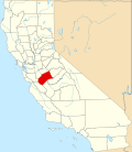 | |
| CDPs | ||
| Unincorporated communities | ||
| Ghost towns | ||