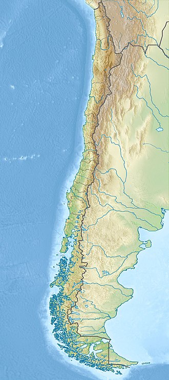
Cerro de Los Inocentes
| Cerro de Los Inocentes | |
|---|---|
| Highest point | |
| Elevation | 1,268 m (4,160 ft) |
| Isolation | 819.66 km (509.31 mi) |
| Coordinates | 33°45′51″S 80°48′30″W / 33.76417°S 80.80833°W |
| Naming | |
| Etymology | Holy Innocents |
| Geography | |
| Location | Alejandro Selkirk Island, Chile |
| Climbing | |
| First ascent | unknown |
Cerro de Los Inocentes (meaning "Hill of the Innocents" in Spanish)[1] is the highest mountain in the Juan Fernández Islands, Valparaíso Region, Chile. Located on the remnant of a basaltic volcano from the Pleistocene in Alejandro Selkirk Island, the area was discovered by Europeans in 1574. The Stejneger's petrel uses the mountain as a burrowing ground.
Geography
[edit]Cerro de Los Inocentes is 1,000 m (3,300 ft) above sea level and is located on Alejandro Selkirk Island, the western-most island of the Juan Fernández Islands in the Pacific Ocean.[2] The summit of the mountain is 1,319 m (4,327 ft) high.[3] It is the tallest mountain in the Juan Fernández Islands[4] and is located on the southern portion of Alejandro Selkirk Island.[5]
The island is located on the remnant of a basaltic volcano from the Pleistocene.[3]
History
[edit]There is currently no known evidence of Polynesians or indigenous peoples inhabitating the island prior to the arrival of Europeans.[5] Europeans first arrived at Alexander Selkirk Island in 1574. In 1935, the entire island was declared a national park.[6]
Environment
[edit]The area has a warm temperate climate with a dry summer and wet winter. There are 75 flowering plant and 45 pteridophyte species native to Alexander Selkirk Island. Dicksonia externa and Histiopteris incisa are present on the mountain.[3] Aristotelia chilensis was introduced to the area in the 1930s. The valleys of the island were covered in a forest prior to the arrival of Europeans, but the slops of Cerro de Los Inocentes were not.[6] Stejneger's petrel burrow on the ridges of the mountain.[7]
See also
[edit]References
[edit]- ^ Howse & Thrower 1992, p. 257.
- ^ Haberle 2003, p. 239.
- ^ a b c Haberle 2003, p. 242.
- ^ Beals 1949, pp. 92–93.
- ^ a b Haberle 2003, p. 241.
- ^ a b Haberle 2003, p. 243.
- ^ Haberle 2003, p. 244.
Works cited
[edit]Books
[edit]- Beals, Carleton (1949). The Long Island Chile. Coward-McCann.
- Howse, Derek; Thrower, Norman, eds. (1992). A Buccaneer’s Atlas. University of California Press. ISBN 9780520426672.
Journals
[edit]- Haberle, Simon (2003). "Late Quaternary Vegetation Dynamics and Human Impact on Alexander Selkirk Island, Chile". Journal of Biogeography. 30 (2). Wiley: 239–255. doi:10.2307/3554517. JSTOR 3554517.

