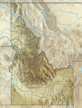
Bench Lakes (Idaho)
| Bench Lakes | |
|---|---|
 Bench Lake 3 | |
| Location | Sawtooth Mountains Custer County, Idaho |
| Coordinates | 44°06′35″N 114°57′57″W / 44.1096°N 114.9659°W |
| Type | Glacial lakes |
| Part of | Sawtooth Wilderness |
| Basin countries | United States |
| Managing agency | U.S. Forest Service |
| Max. length | 110–465 m (361–1,526 ft) |
| Max. width | 95–295 m (312–968 ft) |
| Surface elevation | 2,362–2,632 m (7,749–8,635 ft) |
| Sections/sub-basins | 5 |
The Bench Lakes are a chain of five small alpine glacial lakes in Custer County, Idaho, United States, located in the Sawtooth Mountains in the Sawtooth National Recreation Area. A cutoff from Sawtooth National Forest trail 101 along Redfish Lake leads to the Bench Lakes.[1] The lakes are drained by an unnamed stream that flows into Redfish Lake, Redfish Lake Creek, and eventually the Salmon River.
The Bench Lakes are in the Sawtooth Wilderness, and a wilderness permit can be obtained at a registration box at trailheads or wilderness boundaries. The uppermost Bench Lake is at the northeastern base of Mount Heyburn.
Bench Lakes Fire
[edit]In July 2024, the area nearest to the lakes and Redfish Lake were the site of the Bench Lake Fire.[2][3] The fire, which burned approximately 2,595 acres (1,050 ha), was determined to be "human-caused."[4][5]
| Lake | Elevation | Max. length | Max. width | Location |
|---|---|---|---|---|
| Bench Lake 1 | 2,362 m (7,749 ft) | 190 m (620 ft) | 160 m (520 ft) | 44°07′01″N 114°57′02″W / 44.117031°N 114.950625°W |
| Bench Lake 2 | 2,363 m (7,753 ft) | 465 m (1,526 ft) | 240 m (790 ft) | 44°06′59″N 114°57′19″W / 44.116365°N 114.955179°W |
| Bench Lake 3 | 2,414 m (7,920 ft) | 110 m (360 ft) | 095 m (312 ft) | 44°06′50″N 114°57′48″W / 44.113772°N 114.963439°W |
| Bench Lake 4 | 2,496 m (8,189 ft) | 435 m (1,427 ft) | 295 m (968 ft) | 44°06′35″N 114°57′57″W / 44.109683°N 114.965717°W |
| Bench Lake 5 | 2,632 m (8,635 ft) | 400 m (1,300 ft) | 210 m (690 ft) | 44°06′22″N 114°58′25″W / 44.106147°N 114.973569°W |
-
Lower Bench Lake at sunrise
-
One of the Bench Lakes at sunrise
References
[edit]- ^ "Bench Lakes | Hiking Map". Sawtooth National Forest. U.S. Forestry Service. 2024. Retrieved 14 April 2025.
- ^ "Bench Lake Fire | InciWeb". inciweb.wildfire.gov. 14 April 2025. Retrieved 14 April 2025.
- ^ "2024 Fire Information". Sawtooth National Forest. U.S. Forest Service. Retrieved 14 April 2025.
- ^ Blanchard, Nicole (26 July 2024). "Idaho wildfire near Redfish Lake was human-caused, fire officials determine". Idaho Statesman. Retrieved 14 April 2025.
- ^ Blanchard, Nicole (9 August 2024). "Bench Lake wildfire in Idaho Sawtooths cost millions. Who will pay the bill?". Idaho Statesman. Retrieved 14 April 2025.
See also
[edit]- List of lakes of the Sawtooth Mountains (Idaho)
- Sawtooth National Forest
- Sawtooth National Recreation Area
- Sawtooth Range (Idaho)


