
Bempton
| Bempton | |
|---|---|
 St Michael's Church | |
 Bempton Location within the East Riding of Yorkshire | |
| Population | 1,040 (2011 census)[1] |
| OS grid reference | TA190722 |
| • London | 180 mi (290 km) S |
| Civil parish |
|
| Unitary authority | |
| Ceremonial county | |
| Region | |
| Country | England |
| Sovereign state | United Kingdom |
| Post town | BRIDLINGTON |
| Postcode district | YO15 |
| Dialling code | 01262 |
| Police | Humberside |
| Fire | Humberside |
| Ambulance | Yorkshire |
| UK Parliament | |
Bempton is a village and civil parish in the East Riding of Yorkshire, England, near the border with North Yorkshire. It is near the North Sea coast and Flamborough Head, and is situated about 4 miles (6.4 km) north of Bridlington. It lies on the B1229 road between Speeton and Flamborough. It is served by Bempton railway station which is on the Yorkshire Coast Line that runs between Hull and Scarborough.
The parish of Bempton also contains Buckton village, which is situated directly to the west of Bempton. According to the 2011 UK census, Bempton parish had a population of 1,040,[1] a slight decrease on the 2001 UK census figure of 1,050.[2]
History
[edit]Bronze Age pit dwellings have been discovered near Bempton.[3]
Bempton used to be home to RAF Bempton, an early warning station. It was established in the Second World War as a radar station. It was finally closed in 1972.[4] Some of the old buildings are still visible from the cliff top. The former RAF camp site is now a caravan park.
From the mediaeval era until the 19th century Bempton was part of Dickering Wapentake.[5] Between 1894 and 1974 Bempton was a part of the Bridlington Rural District, in the East Riding of Yorkshire.[6] Between 1974 and 1996 it was part of the Borough of North Wolds (later Borough of East Yorkshire), in the county of Humberside.
Amenities
[edit]The village is well known for its cliffs which are located one mile from the centre of the village. Bempton Cliffs is an RSPB nature reserve, established in 1970. It is best known for its breeding seabirds, including northern gannet, Atlantic puffin, razorbill, common guillemot, black-legged kittiwake and fulmar. In places the cliffs are 400 foot high and it is the only mainland gannetry in the UK where these birds breed every year.[7]
The parish church of St Michael is a Grade II* listed building and dates back to the 13th century.[8]
Bempton has a post office and general store, a garage, a hairdresser, antique shop and snooker club. It is home to Bempton Primary School, which was completely rebuilt in 2004 at a cost of over £1 million.[9]
It also has a public house, The White Horse, which has a distinctive vivid blue Dutch tiled roof. It is local folklore that no other tiles were readily available at the time of construction so the it was decided to use the blue tiles instead of waiting for delivery of standard tiles.[10]
In 2014, after many years of fundraising and a lottery grant of £408,000, Bempton and Buckton Community Village Hall was opened on land between the two villages.[11] There is also a children's playground close to the village hall.[12]
Bempton, along with a number of other places in Yorkshire, was a filming location for the 2016 film Dad's Army, starring Catherine Zeta-Jones.[13]
Gallery
[edit]-
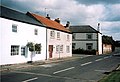 18th-century houses, High Street
 -
 The mere
 -
 Old windmill at Mill Farm
 -
 White Horse pub


See also
[edit]References
[edit]- ^ a b UK Census (2011). "Local Area Report – Bempton Parish (1170211141)". Nomis. Office for National Statistics. Retrieved 15 February 2018.
- ^ UK Census (2001). "Local Area Report – Bempton Parish (1543504188)". Nomis. Office for National Statistics. Retrieved 24 November 2018.
- ^ "Settlement profile of Bemption" (PDF). East Riding of Yorkshire Council. 7 November 2008. Archived from the original (PDF) on 29 November 2014. Retrieved 20 November 2014.
- ^ "Airfields". Hull & East Riding at war. Retrieved 15 February 2016.
- ^ "Dickering-Wap through time". A Vision of Britain Through Time. University of Portsmouth. Retrieved 24 November 2019.
- ^ "Bridlington RD". A Vision of Britain Through Time. University of Portsmouth. Archived from the original on 10 February 2012. Retrieved 11 April 2013.
- ^ "Towns and Villages Around Bridlington | Bempton". www.visitoruk.com. Retrieved 24 February 2025.
- ^ Historic England. "Church of St Michael (1161842)". National Heritage List for England. Retrieved 27 June 2013.
- ^ "School Building Programme". East Riding News. East Riding of Yorkshire Council: 13. December 2004. Archived from the original (PDF) on 9 June 2011. Retrieved 3 February 2013.
- ^ "White Horse charity cash handout". Bridlington Echo. 2 April 2017. Retrieved 24 February 2025.
- ^ "After Decades In The Pipeline- Work starts On Bempton Village Hall". Yorkshire Coast Radio. Retrieved 13 April 2014.
- ^ "Bempton – High Street Play Area". East Riding of Yorkshire Council. Retrieved 26 November 2019.
- ^ Armstrong, Hayley (4 February 2016). "Which Yorkshire Filming Locations Appear in 'Dad's Army'?". Creative England. Retrieved 26 November 2019.
- Gazetteer — A–Z of Towns Villages and Hamlets. East Riding of Yorkshire Council. 2006. p. 3.
External links
[edit]- Historic England. "St Michael's Church (1161842)". National Heritage List for England.
- Bempton in the Domesday Book
- Bempton Primary School website
- Bempton and Buckton Community Village Hall
| Statutory City Region | |
|---|---|
| Unitary authorities | |
| Major settlements (cities in italics) | |
| Rivers | |
| Canals | |
| Topics | |