Al Azaiba Airport
It is proposed that this article be deleted because of the following concern:
If you can address this concern by improving, copyediting, sourcing, renaming, or merging the page, please edit this page and do so. You may remove this message if you improve the article or otherwise object to deletion for any reason. Although not required, you are encouraged to explain why you object to the deletion, either in your edit summary or on the talk page. If this template is removed, do not replace it. The article may be deleted if this message remains in place for seven days, i.e., after 15:41, 18 August 2025 (UTC). Find sources: "Al Azaiba Airport" – news · newspapers · books · scholar · JSTOR |
Another editor has reviewed this page's proposed deletion, endorses the proposal to delete, and adds:
If you remove the {{proposed deletion/dated}} tag above, please also remove this {{Proposed deletion endorsed}} tag. |
The topic of this article may not meet Wikipedia's general notability guideline. (August 2025) |
Al Azaiba Airport مطار العذيبة | |
|---|---|
| Summary | |
| Operator | Sultan's Special Force |
| Opened | 1957 |
| Closed | circa 1960s |
| Elevation AMSL | 39 ft / 12 m |
| Coordinates | 23°0′0″N 58°0′0″E / 23.00000°N 58.00000°E |
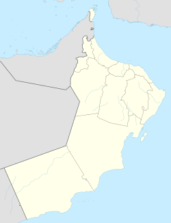
| Map | |
 | |
Al Azaiba Airport (Arabic: مطار العذيبة) is an old airfield in Muscat, Oman, near Bayt al-Falaj. The airport was opened in 1957 and was originally used by Petroleum Development Oman; it is now used by the Sultan's Special Force.[1]
The airport closed around 1960 and ceased operations in 1973; Seeb International Airport replaced it.[2]
See also
[edit]References
[edit]- ^ Ranter, Harro. "Azaiba Airfield profile - Aviation Safety Network". aviation-safety.net. Retrieved 2025-08-03.
- ^ "Wayback Machine" (PDF). www.omanairports.co.om. Archived from the original (PDF) on 2025-03-27. Retrieved 2025-08-03.
External links
[edit]

