
Nang County
Nang County
朗县 • སྣང་རྫོང་། | |
|---|---|
 Ba'er Qudesi in Nang County | |
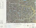
 Nang Location of the seat in Tibet  Nang Nang (China) | |
| Coordinates: 29°17′40″N 93°22′30″E / 29.29444°N 93.37500°E | |
| Country | China |
| Autonomous region | Tibet |
| Prefecture-level city | Nyingchi |
| County seat | Nang |
| Area | |
• Total | 4,120 km2 (1,590 sq mi) |
| Population (2020)[1] | |
• Total | 17,648 |
| • Density | 4.3/km2 (11/sq mi) |
| Time zone | UTC+8 (China Standard) |
| Website | www |
| Nang County | |||||||
|---|---|---|---|---|---|---|---|
| Chinese name | |||||||
| Simplified Chinese | 朗县 | ||||||
| Traditional Chinese | 朗縣 | ||||||
| |||||||
| Tibetan name | |||||||
| Tibetan | སྣང་རྫོང་། | ||||||
| |||||||
Nang County (Tibetan: སྣང་རྫོང་།; Chinese: 朗县) is a county under the jurisdiction of Nyingtri City in the Tibet Autonomous Region, China.
Geography
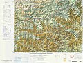
[edit]Nang is located in the south-west of Nyingtri, at the middle and lower reaches of the Yarlung Tsangpo River. The county seat of Nang County is situated in a region resembling an elephant's trunk, leading to the metaphorical designation of this area as "Nang" which translates to elephant.[2] The average altitude is 5,000 metres above sea level.[3][4]
Administrative divisions
[edit]Nang County contains 3 towns and 3 townships.
| Name | Chinese | Hanyu Pinyin | Tibetan | Wylie | |||
|---|---|---|---|---|---|---|---|
| Towns | |||||||
| Nang Town | 朗镇 | Lǎng zhèn | སྣང་གྲོང་རྡལ། | snang grong rdal | |||
| Dromda Town | 仲达镇 | Zhòngdá zhèn | སྒྲོམ་མདའ་གྲོང་རྡལ། | sgrom mda' grong rdal | |||
| Dungkar Town | 洞嘎镇 | Dònggā zhèn | དུང་དཀར་གྲོང་རྡལ། | dung dkar grong rdal | |||
| Townships | |||||||
| Latok Township | 拉多乡 | Lāduō xiāng | ལ་ཐོག་ཤང་། | la thog shang | |||
| Kyemtong Township | 金东乡 | Jīndōng xiāng | སྐྱེམས་སྟོང་ཤང་། | skyem stong shang | |||
| Dem Township | 登木乡 | Dēngmù xiāng | ལྡེམ་ཤང་། | ldem shang | |||
* includes areas claimed but currently under control of the Indian state of Arunachal Pradesh. | |||||||
Gallery
[edit]-
-
-
 Yarlung Tsangpo in Nang County
 -
 mudslides
 -
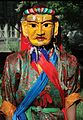 Tibetan goddess of fortune-telling in Ba'er Qudesi


.jpg)
Transportation
[edit]In 1965, the Linzhi-Qiongduo River highway traversed Nang County, and in 2005, the Jiangbei Highway was inaugurated, extending through 18 administrative villages and 2 townships in Nang County. China National Highway 219 also traverses Langxian County. The Lhasa–Nyingchi railway commenced operations in 2021, featuring Nang County station.[5][6]
References
[edit]- ^ "林芝市第七次全国人口普查主要数据公报" (in Chinese). Government of Nyingchi. 2021-06-17.
- ^ 雪域高原的璀璨明珠: 林芝 (in Chinese). 西藏人民出版社. 2002. p. 11. ISBN 978-7-223-01478-6. Retrieved 2025-02-18.
- ^ 西藏自治区地理. 中国地理丛书 (in Chinese). 西藏人民出版社. 1986. p. 12. ISBN 978-7-223-00428-2. Retrieved 2025-02-18.
- ^ 中国地理. 复印报刊资料 (in Chinese). 中国人民大学出版社. 1984. p. 94. Retrieved 2025-02-18.
- ^ "拉林铁路林芝段首座火车站成功封顶_滚动新闻_中国政府网". 中国政府网_中央人民政府门户网站 (in Chinese). 2023-05-26. Retrieved 2025-02-18.
- ^ "拉林铁路今日开通运营 3小时29分到林芝_西藏自治区文化和旅游厅". 西藏自治区文化和旅游厅. 2021-06-25. Retrieved 2025-02-18.
