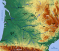
File:Topographic map of South-West France with main rivers and cities.svg
Appearance

Size of this PNG preview of this SVG file: 696 × 599 pixels. Other resolutions: 279 × 240 pixels | 558 × 480 pixels | 892 × 768 pixels | 1,190 × 1,024 pixels | 2,379 × 2,048 pixels | 1,028 × 885 pixels.
Original file (SVG file, nominally 1,028 × 885 pixels, file size: 2.9 MB)
File history
Click on a date/time to view the file as it appeared at that time.
| Date/Time | Thumbnail | Dimensions | User | Comment | |
|---|---|---|---|---|---|
| current | 12:26, 13 March 2010 |  | 1,028 × 885 (2.9 MB) | Pethrus | Mediawiki bug with "text along path" fix, slightly bigger fonts |
| 19:47, 11 March 2010 |  | 1,028 × 885 (2.9 MB) | Pethrus | {{Information |Description={{en|Topographic map of the South-West of France with main rivers and cities}}{{fr|Carte topographique du Sud-Ouest de la France avec rivières et villes principales}} |Source={{own}} based on a [http://www.maps-for-free.com www |
File usage
The following 2 pages use this file:
Global file usage
The following other wikis use this file:
- Usage on fr.wikipedia.org
- Usage on sl.wikipedia.org
- Usage on zh.wikipedia.org

