
File:Spuyten Duyvil derailment site map.svg

Size of this PNG preview of this SVG file: 599 × 594 pixels. Other resolutions: 242 × 240 pixels | 484 × 480 pixels | 774 × 768 pixels | 1,033 × 1,024 pixels | 2,065 × 2,048 pixels.
Original file (SVG file, nominally 599 × 594 pixels, file size: 163 KB)
| This is a file from the Wikimedia Commons. Information from its description page there is shown below. Commons is a freely licensed media file repository. You can help. |
| Description |
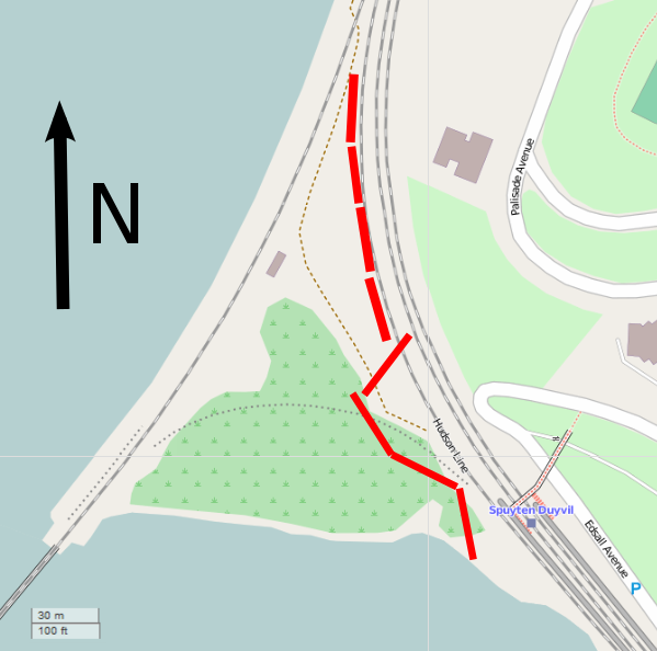
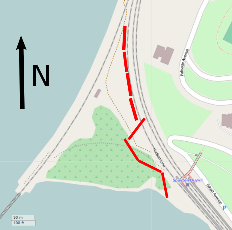
English: Map of the Spuyten Duyvil derailment site, with derailed cars' locations indicated in red. |
||
| Date | |||
| Source | Own work | ||
| Author | Daniel Case. Map layer by OpenStreetMap contributors | ||
| Permission (Reusing this file) |
I, the copyright holder of this work, hereby publish it under the following licenses:
This file is licensed under the Creative Commons Attribution-Share Alike 3.0 Unported license.
You may select the license of your choice. |

| Description |
This map was created from OpenStreetMap project data, collected by the community. This map may be incomplete, and may contain errors. Don't rely solely on it for navigation. |
|||
| Date | (see file history) | |||
| Source | openstreetmap.org | |||
| Creator |
OpenStreetMap contributors |
|||
| Permission (Reusing this file) |
OpenStreetMap data is available under the Open Database License (details). Map tiles are licensed under the Creative Commons Attribution-ShareAlike 2.0 license (CC-BY-SA 2.0).
This file is licensed under the Creative Commons Attribution-Share Alike 2.0 Generic license.
|
|||
| Georeferencing | If inappropriate please set warp_status = skip to hide. |
File history
Click on a date/time to view the file as it appeared at that time.
| Date/Time | Thumbnail | Dimensions | User | Comment | |
|---|---|---|---|---|---|
| current | 21:44, 20 May 2020 | | 599 × 594 (163 KB) | Phoenix7777 | Replaced a flowed text with a normal text |
| 04:12, 10 December 2013 |  | 599 × 594 (165 KB) | Daniel Case | Tightened to just map image | |
| 04:01, 10 December 2013 |  | 744 × 1,052 (165 KB) | Daniel Case | {{Information |Description ={{en|1=Map of the Spuyten Duyvil derailment site, with derailed cars' locations indicated in red.}} |Source ={{own}} |Author =Daniel Case.... |
File usage
The following page uses this file: