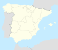
File:Spain location map.svg
Appearance

Size of this PNG preview of this SVG file: 699 × 600 pixels. Other resolutions: 280 × 240 pixels | 559 × 480 pixels | 895 × 768 pixels | 1,193 × 1,024 pixels | 2,387 × 2,048 pixels | 1,184 × 1,016 pixels.
Original file (SVG file, nominally 1,184 × 1,016 pixels, file size: 536 KB)
File history
Click on a date/time to view the file as it appeared at that time.
| Date/Time | Thumbnail | Dimensions | User | Comment | |
|---|---|---|---|---|---|
| current | 14:23, 7 July 2008 |  | 1,184 × 1,016 (536 KB) | NordNordWest | |
| 13:58, 4 July 2008 |  | 1,184 × 1,016 (785 KB) | NordNordWest | corrected | |
| 13:54, 4 July 2008 |  | 1,184 × 1,016 (791 KB) | NordNordWest | {{Information |Description= {{de|Positionskarte von Spanien}} Quadratische Plattkarte, N-S-Streckung 130 %. Geographische Begrenzung der Karte: * N: 44.4° N * S: 34.7° N * W: 9.9° W * O: 4.8° O {{en|Location map of Spain} |
File usage
The following 8 pages use this file:
- Caleta de Velez
- Cave of the Angel
- User:Noclador/sandbox/Air base maps 1989 - 2024
- Wikipedia:Graphics Lab/Map workshop/Archive/Apr 2012
- Wikipedia:Graphics Lab/Map workshop/Archive/Jun 2011
- Wikipedia:WikiProject Maps/Conventions/Location maps
- Module:Location map/data/Spain
- Module:Location map/data/Spain/doc
Global file usage
The following other wikis use this file:
- Usage on bcl.wikipedia.org
- Usage on bn.wikipedia.org
- Usage on bs.wikipedia.org
- Usage on ca.wikipedia.org
- Usage on ckb.wikipedia.org
- Usage on de.wikipedia.org
- Usage on es.wikipedia.org
- Usage on et.wikipedia.org
- Santander
- Burgos
- Ayerbe
- Valencia
- Madrid
- Santiago de Compostela
- Córdoba
- Murcia
- Zaragoza
- Barcelona
- Marbella
- Toledo
- A Coruña
- Melilla
- Ceuta
- Olivenza
- Villarrobledo
- Badajoz
- Donostia
- Tortosa
- Terrassa
- Girona
- Vilanova i la Geltrú
- La Línea de la Concepción
- Chiclana de la Frontera
- Caravaca de la Cruz
- Ubrique
- Jerez de la Frontera
View more global usage of this file.


