
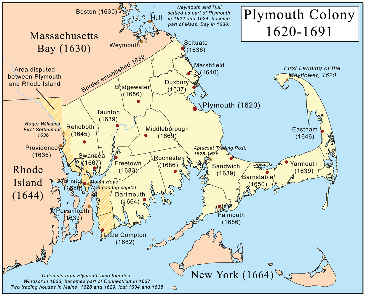
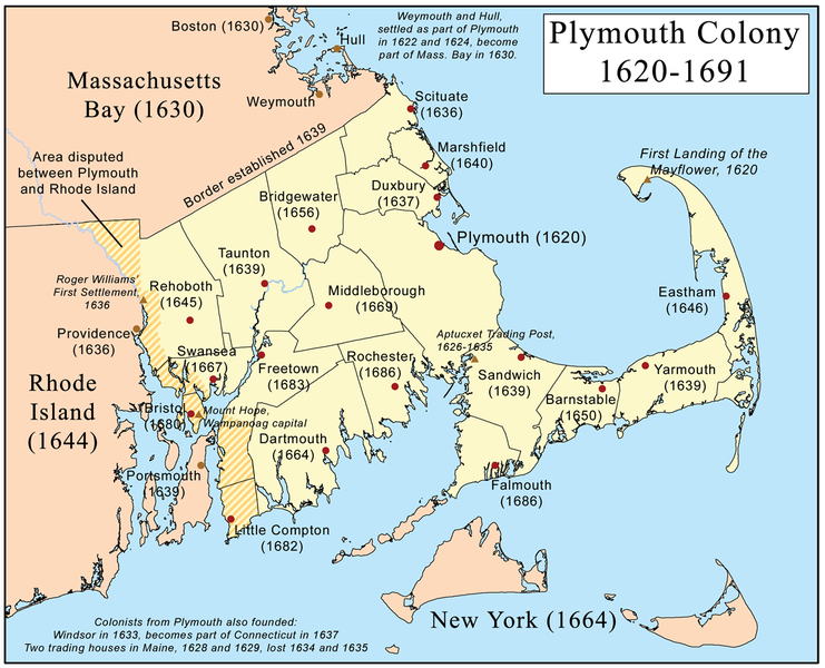
File:Plymouthcolonymap.png
Size of this preview: 741 × 600 pixels. Other resolutions: 297 × 240 pixels | 593 × 480 pixels | 949 × 768 pixels | 1,235 × 1,000 pixels.
Original file (1,235 × 1,000 pixels, file size: 659 KB, MIME type: image/png)
| This is a file from the Wikimedia Commons. Information from its description page there is shown below. Commons is a freely licensed media file repository. You can help. |
Summary

|
File:Plymouth Colony map.svg is a vector version of this file. It should be used in place of this PNG file when not inferior.
File:Plymouthcolonymap.png → File:Plymouth Colony map.svg
For more information, see Help:SVG. |
 |
Licensing
I, the copyright holder of this work, hereby publish it under the following license:
This file is licensed under the Creative Commons Attribution-Share Alike 3.0 Unported license.
- You are free:
- to share – to copy, distribute and transmit the work
- to remix – to adapt the work
- Under the following conditions:
- attribution – You must give appropriate credit, provide a link to the license, and indicate if changes were made. You may do so in any reasonable manner, but not in any way that suggests the licensor endorses you or your use.
- share alike – If you remix, transform, or build upon the material, you must distribute your contributions under the same or compatible license as the original.
File history
Click on a date/time to view the file as it appeared at that time.
| Date/Time | Thumbnail | Dimensions | User | Comment | |
|---|---|---|---|---|---|
| current | 11:05, 8 October 2009 | | 1,235 × 1,000 (659 KB) | Kmusser | spelling correction |
| 14:04, 20 February 2008 |  | 1,235 × 1,000 (439 KB) | Kmusser | spelling corrections | |
| 04:01, 25 September 2007 |  | 1,235 × 1,000 (527 KB) | Mazin07 | Optimized with optipng -o6 | |
| 17:58, 18 June 2007 |  | 1,235 × 1,000 (659 KB) | Kmusser | changed Weymouth date to 1622 | |
| 12:59, 18 June 2007 |  | 1,235 × 1,000 (659 KB) | Kmusser | spelling correction | |
| 20:49, 12 June 2007 |  | 1,235 × 1,000 (659 KB) | Kmusser | {{Information |Description=This is a map of Plymouth Colony that I made. |Source=self-made |Date=June 12, 2007 |Author= Kmusser }} == Licensing == {{self|cc-by-sa-2.5}} Category:Maps of the Thirteen colonies |
File usage
The following 7 pages use this file:
Global file usage
The following other wikis use this file:
- Usage on be.wikipedia.org
- Usage on bg.wikipedia.org
- Usage on da.wikipedia.org
- Usage on en.wikiversity.org
- Usage on fr.wikipedia.org
- Usage on ga.wikipedia.org
- Usage on gd.wikipedia.org
- Usage on hy.wikipedia.org
- Usage on id.wikipedia.org
- Usage on is.wikipedia.org
- Usage on it.wikipedia.org
- Usage on ja.wikipedia.org
- Usage on ko.wikipedia.org
- Usage on lt.wikipedia.org
- Usage on nl.wikipedia.org
- Usage on ro.wikipedia.org
- Usage on sr.wikipedia.org
- Usage on sv.wikipedia.org
- Usage on uk.wikipedia.org
- Usage on vi.wikipedia.org
- Usage on zh.wikipedia.org