
File:North Holland 1st-10th Century.jpg
Size of this preview: 800 × 391 pixels. Other resolutions: 320 × 156 pixels | 640 × 313 pixels | 1,198 × 585 pixels.
Original file (1,198 × 585 pixels, file size: 643 KB, MIME type: image/jpeg)
| This is a file from the Wikimedia Commons. Information from its description page there is shown below. Commons is a freely licensed media file repository. You can help. |
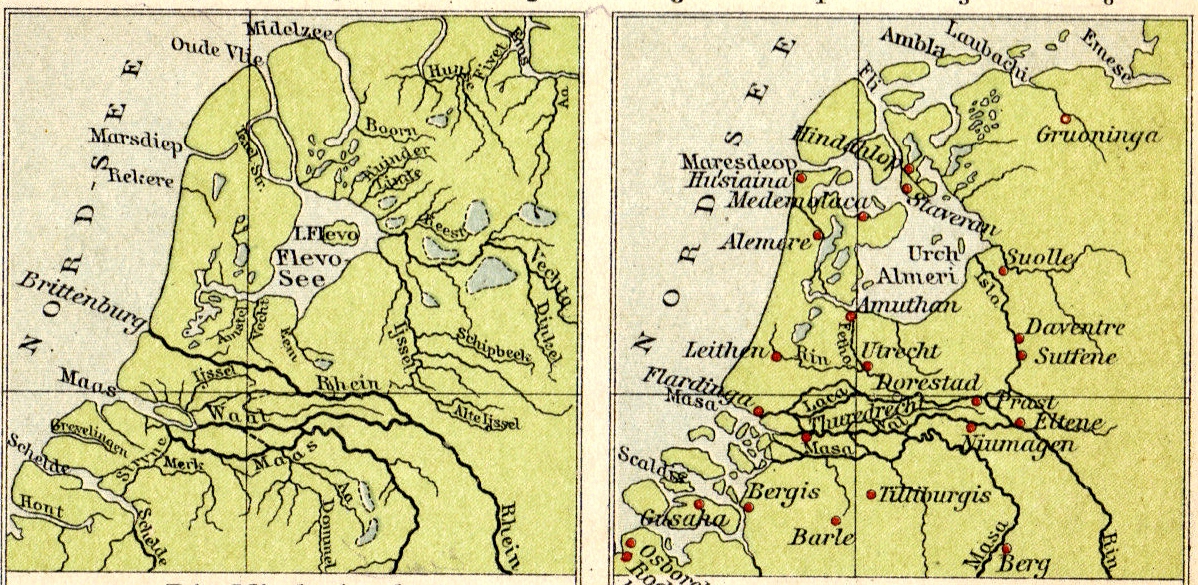
Summary
| Description | Formation of the Zuider Zee during the first millennium A.D. |
| Date | |
| Source | Tramplers Geographischer Mittelschulatlas, 8th Ed., Wien (Austria) |
| Author |
Licensing
|
This work is in the public domain in its country of origin and other countries and areas where the copyright term is the author's life plus 70 years or fewer. | |
| This file has been identified as being free of known restrictions under copyright law, including all related and neighboring rights. | |
File history
Click on a date/time to view the file as it appeared at that time.
| Date/Time | Thumbnail | Dimensions | User | Comment | |
|---|---|---|---|---|---|
| current | 12:36, 4 July 2007 | | 1,198 × 585 (643 KB) | Hermann A.M. Mucke | {{Information |Description=Formation of the Zuider Zee during the first millennium A.D. |Source=Tramplers Geographischer Mittelschulatlas, 8th Ed., Wien (Austria) |Date=1913 |Author= |Permission= |other_versions= }} Category:Old maps of North Holland |
File usage
The following page uses this file:
Global file usage
The following other wikis use this file:
- Usage on ar.wikipedia.org
- Usage on ca.wikipedia.org
- Usage on cs.wikipedia.org
- Usage on da.wikipedia.org
- Usage on de.wikipedia.org
- Usage on de.wikivoyage.org
- Usage on es.wikipedia.org
- Usage on fr.wikipedia.org
- Usage on ga.wikipedia.org
- Usage on it.wikipedia.org
- Usage on ja.wikipedia.org
- Usage on nn.wikipedia.org
- Usage on pt.wikipedia.org
- Usage on ro.wikipedia.org
- Usage on ru.wikipedia.org
- Usage on sr.wikipedia.org
- Usage on uk.wikipedia.org