
File:Martello towers worldwide map.png
Size of this preview: 800 × 398 pixels. Other resolutions: 320 × 159 pixels | 640 × 319 pixels | 1,261 × 628 pixels.
Original file (1,261 × 628 pixels, file size: 41 KB, MIME type: image/png)
| This is a file from the Wikimedia Commons. Information from its description page there is shown below. Commons is a freely licensed media file repository. You can help. |
Summary
| Description |
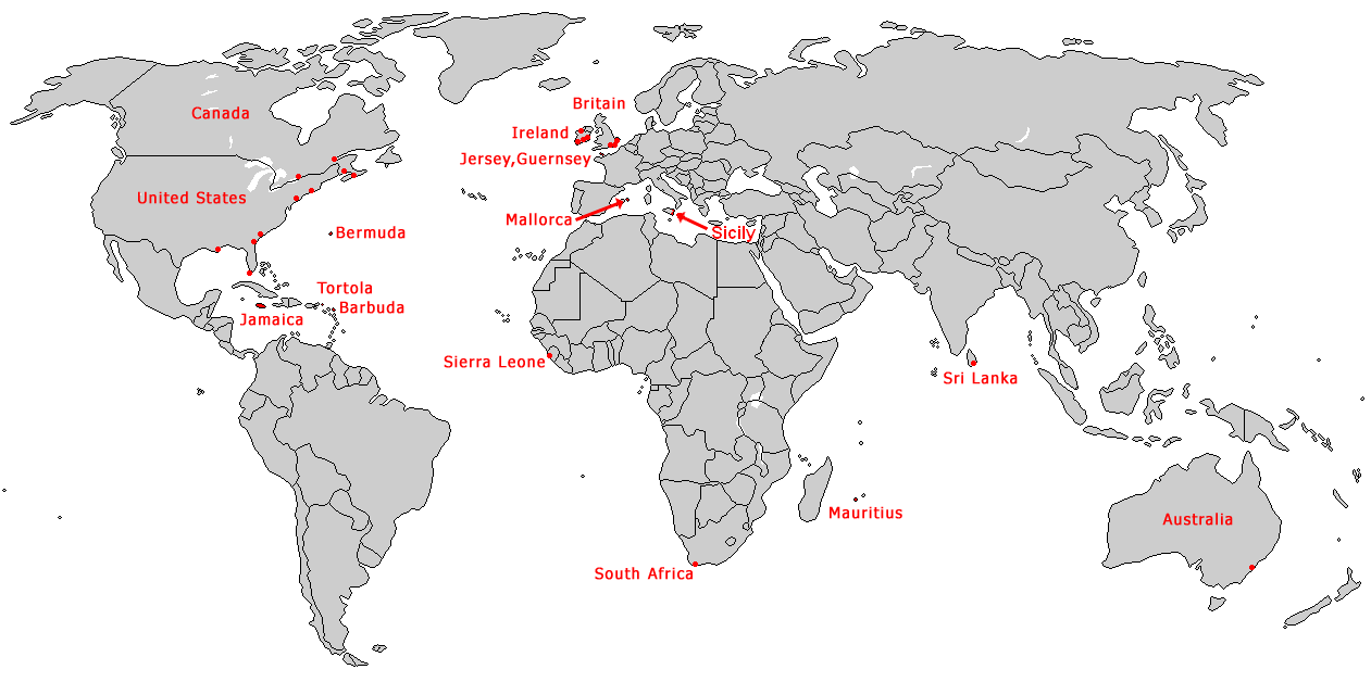
English: Map of worldwide distribution of Martello towers. |
||
| Date | |||
| Source | Self-created, based on Image:BlankMap-World-Borders.png | ||
| Author | ChrisO | ||
| Permission (Reusing this file) |
|
File history
Click on a date/time to view the file as it appeared at that time.
| Date/Time | Thumbnail | Dimensions | User | Comment | |
|---|---|---|---|---|---|
| current | 16:40, 12 January 2012 | | 1,261 × 628 (41 KB) | Archeo | Add Sicily |
| 21:06, 29 March 2007 |  | 1,261 × 628 (27 KB) | ChrisO | == Summary == {{Information |Description= {{en|Burning the United States flag}} |Source=Self-created, based on Image:BlankMap-World-Borders.png |Date=8 March 2007 |Author=ChrisO |Permission= {{PD-self}} }} |
File usage
The following page uses this file:
Global file usage
The following other wikis use this file:
- Usage on ca.wikipedia.org
- Usage on da.wikipedia.org
- Usage on de.wikipedia.org
- Usage on fr.wikipedia.org
- Usage on hu.wikipedia.org
- Usage on it.wikipedia.org
- Usage on ja.wikipedia.org
- Usage on lt.wikipedia.org
- Usage on lv.wikipedia.org
- Usage on nl.wikipedia.org
- Usage on ru.wikipedia.org
- Usage on sl.wikipedia.org