
File:Map of Pyongyang - 1946 - Yanggak Bridge.png

Size of this preview: 758 × 600 pixels. Other resolutions: 304 × 240 pixels | 607 × 480 pixels | 971 × 768 pixels | 1,072 × 848 pixels.
Original file (1,072 × 848 pixels, file size: 1.95 MB, MIME type: image/png)
| This is a file from the Wikimedia Commons. Information from its description page there is shown below. Commons is a freely licensed media file repository. You can help. |
Summary
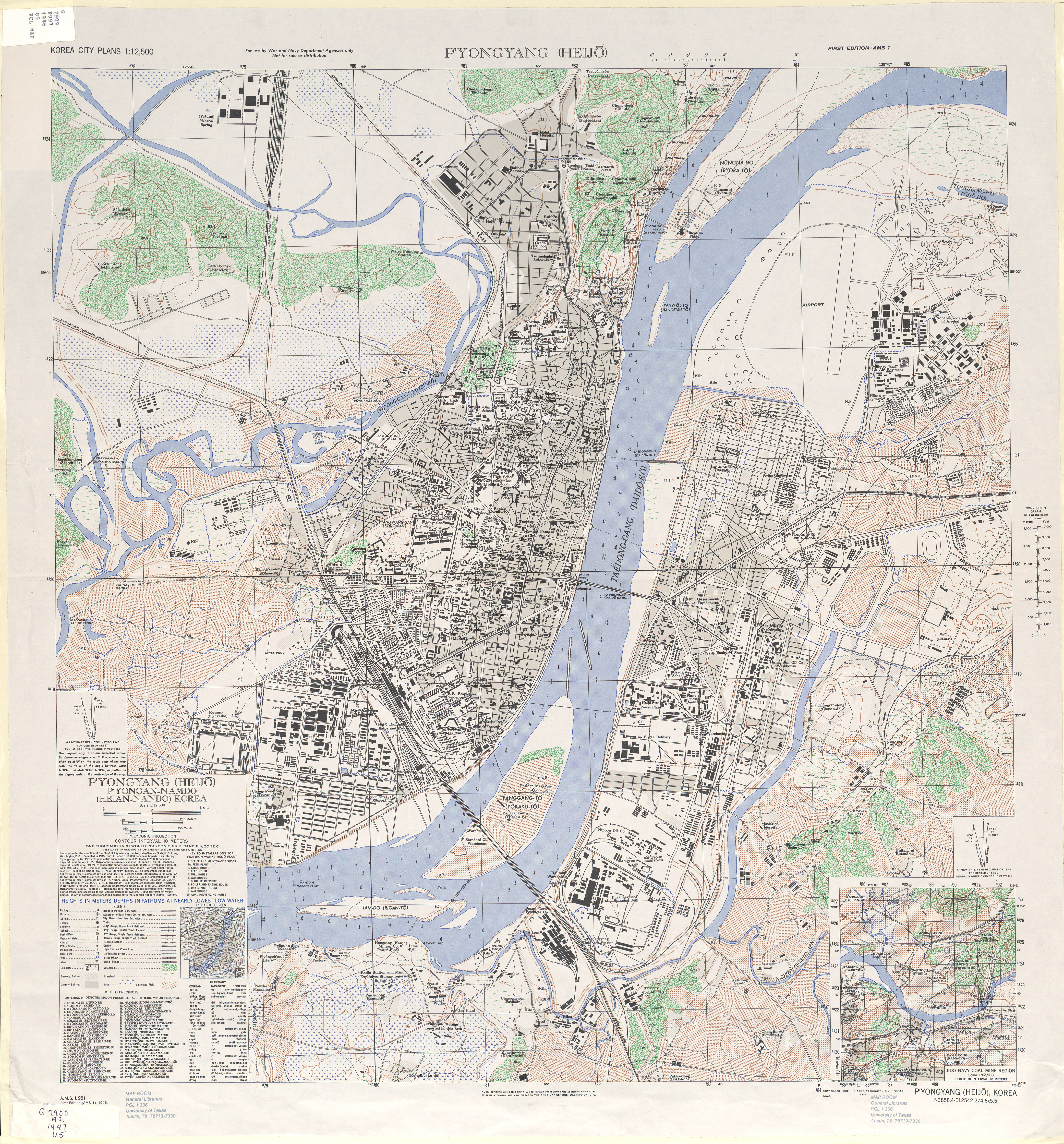
| Description |
English: 1946 Map of Pyongyang (Heijo), North Korea by the Army Map Service, U.S. Army |
| Date | |
| Source | http://www.lib.utexas.edu/maps/ams/korea_city_plans/txu-oclc-6565231.jpg |
| Author |
Army Map Service, U.S. Army, Washington D.C. |
| Other versions |

| This is a retouched picture, which means that it has been digitally altered from its original version. Modifications: Ausschnitt. The original can be viewed here: 1946 Map of Pyongyang, Army Map Service, US Army.jpg:
|
Licensing
This file is a work of a U.S. Army soldier or employee, taken or made as part of that person's official duties. As a work of the U.S. federal government, it is in the public domain in the United States.
|
 |
Original upload log
This image is a derivative work of the following images:
- File:1946 Map of Pyongyang, Army Map Service, US Army.jpg licensed with PD-USGov-Military-Army
- 2010-02-11T07:49:55Z AniRaptor2001 4168x4481 (8116435 Bytes) {{Information |Description={{en|1=1946 Map of Pyongyang (Heijo), North Korea by the Army Map Service, U.S. Army}} |Source=http://www.lib.utexas.edu/maps/ams/korea_city_plans/txu-oclc-6565231.jpg |Author=Army Map Service, U.S.
File history
Click on a date/time to view the file as it appeared at that time.
| Date/Time | Thumbnail | Dimensions | User | Comment | |
|---|---|---|---|---|---|
| current | 12:50, 25 August 2011 | | 1,072 × 848 (1.95 MB) | Nicor | {{Information |Description={{en|1=1946 Map of Pyongyang (Heijo), North Korea by the Army Map Service, U.S. Army}} |Source=*File:Pyongyangarmymapservice1946.png |Date=2011-08-25 12:49 (UTC) |Author=*File:Pyongyangarmymapservice1946.png: Army Ma |
File usage
The following page uses this file:
Global file usage
The following other wikis use this file:
- Usage on cs.wikipedia.org
- Usage on de.wikipedia.org
- Usage on fa.wikipedia.org
- Usage on ko.wikipedia.org
- Usage on tl.wikipedia.org
- Usage on www.wikidata.org
- Usage on zh.wikipedia.org