
File:Map of Alaska highlighting Kodiak Island Borough.svg

Size of this PNG preview of this SVG file: 800 × 423 pixels. Other resolutions: 320 × 169 pixels | 640 × 338 pixels | 1,024 × 541 pixels | 1,280 × 677 pixels | 2,560 × 1,353 pixels | 1,470 × 777 pixels.
Original file (SVG file, nominally 1,470 × 777 pixels, file size: 644 KB)
| This is a file from the Wikimedia Commons. Information from its description page there is shown below. Commons is a freely licensed media file repository. You can help. |
Summary
| Description |
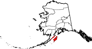
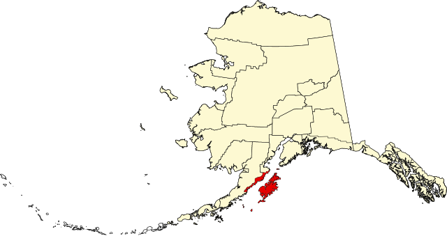
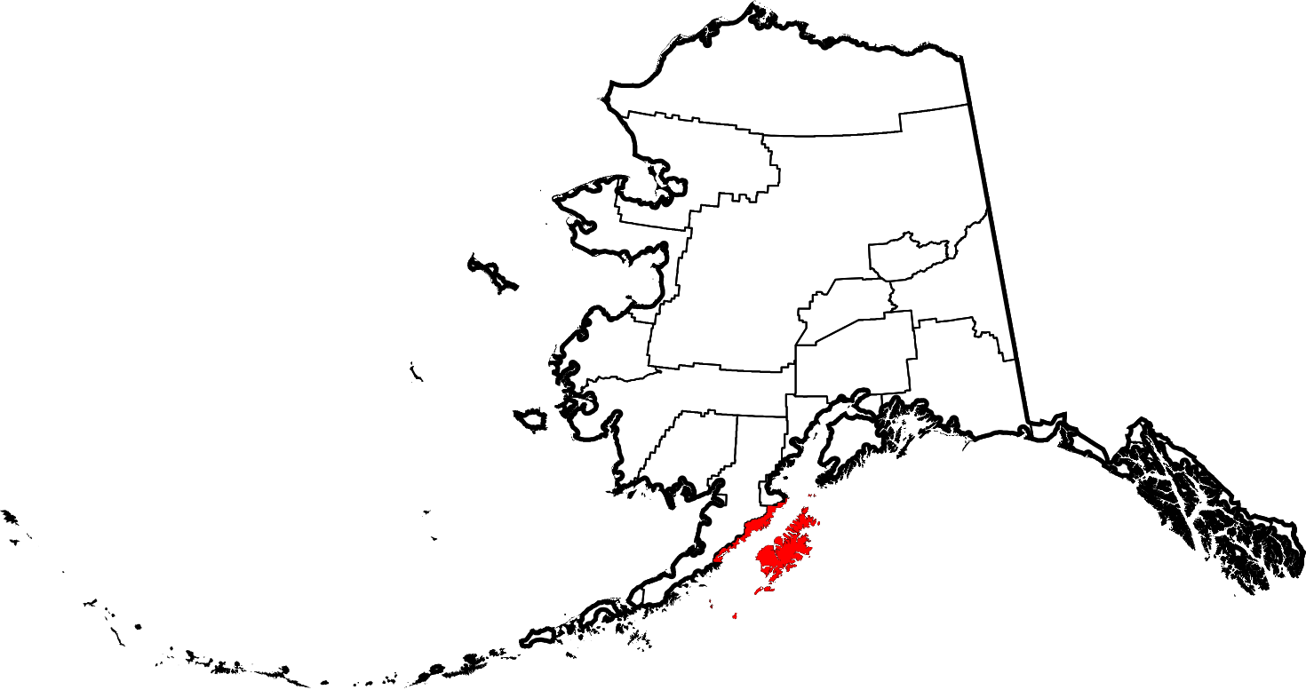
English: This is a locator map showing Kodiak Island Borough in Alaska |
| Date | |
| Source |
Own work: English: The maps use data from nationalatlas.gov, specifically countyp020.tar.gz on the Raw Data Download page. The maps also use state outline data from statesp020.tar.gz. The Florida maps use hydrogm020.tar.gz to display Lake Okeechobee. |
| Author | David Benbennick |
Licensing
| I, the copyright holder of this work, release this work into the public domain. This applies worldwide. In some countries this may not be legally possible; if so: I grant anyone the right to use this work for any purpose, without any conditions, unless such conditions are required by law. |
File history
Click on a date/time to view the file as it appeared at that time.
| Date/Time | Thumbnail | Dimensions | User | Comment | |
|---|---|---|---|---|---|
| current | 20:10, 25 June 2024 | | 1,470 × 777 (644 KB) | Nux | uniform colors with good contrast |
| 20:07, 25 June 2024 |  | 1,470 × 777 (644 KB) | Nux | uniform colors with good contrast | |
| 23:16, 17 June 2024 |  | 1,470 × 777 (338 KB) | Nux | fix rendering (remove clipping) | |
| 23:12, 17 June 2024 |  | 1,470 × 777 (338 KB) | Nux | fix rendering (remove clipping) | |
| 19:27, 5 March 2006 |  | 1,470 × 777 (338 KB) | David Benbennick | {{subst:User:Dbenbenn/clm|county=Kodiak Island Borough|state=Alaska|type=borough and census area}} |
File usage
The following 75 pages use this file:
- Afognak
- Afognak, Alaska
- Agricultural Experiment Station Barn
- Aiaktalik Island
- Akhiok, Alaska
- Aleneva, Alaska
- Ascension of Our Lord Chapel
- Ayakulik River
- Buskin River
- Cape Alitak
- Cape Ugat
- Chiniak, Alaska
- Chirikof Island
- Church of the Nativity of the Theotokos, Afognak
- Devils Desk
- Fort Abercrombie State Historical Park
- Fourpeaked Glacier
- Frazer Lake
- Hog Island (Kodiak Archipelago)
- Holy Resurrection Church (Kodiak, Alaska)
- Kad'yak
- Kaguyak Village Site
- Karluk, Alaska
- Karluk Lake
- Karluk River
- Kodiak, Alaska
- Kodiak Daily Mirror
- Kodiak Island
- Kodiak Island Borough, Alaska
- Kodiak Station, Alaska
- Larsen Bay, Alaska
- List of boroughs and census areas in Alaska
- Marmot Island
- Mill Bay, Alaska
- Mount Denison
- Mount Kaguyak
- Mount Kialagvik
- Mount Mageik
- National Register of Historic Places listings in Kodiak Island Borough, Alaska
- Nativity of Our Lord Chapel
- Near Island (Alaska)
- Old Harbor, Alaska
- Ouzinkie, Alaska
- Ouzinkie Narrows
- Port Lions, Alaska
- Port Wakefield, Alaska
- Protection of the Theotokos Chapel
- Queer Island
- Raspberry Island (Alaska)
- Semidi Islands
- Shelikof Strait
- Shuyak Island
- Shuyak Island State Park
- Sitkalidak Island
- Sitkinak Island
- Spruce Island (Alaska)
- Sts. Sergius and Herman of Valaam Chapel
- Three Brothers (islands), Alaska
- Three Saints Bay, Alaska
- Tugidak Island
- Uganik, Alaska
- Uganik Bay
- Uganik Island
- Uganik River
- Whale Island (Alaska)
- Womens Bay, Alaska
- Woody Island (Alaska)
- User:AridCeption/sandbox
- User:Jnestorius/Regions with significant island landmass
- User:Nyttend/County templates/AK
- Wikipedia:WikiProject Alaska
- File talk:Map of Alaska highlighting Kodiak Island Borough.svg
- Template:KodiakIslandAK-geo-stub
- Template:Kodiak Island Borough, Alaska
- Category:Populated places in Kodiak Island Borough, Alaska
Global file usage
The following other wikis use this file:
- Usage on bpy.wikipedia.org
- Usage on ca.wikipedia.org
- Usage on ceb.wikipedia.org
- Usage on ce.wikipedia.org
- Usage on cy.wikipedia.org
- Usage on de.wikipedia.org
- Usage on es.wikipedia.org
- Usage on fi.wikipedia.org
- Usage on fr.wikipedia.org
View more global usage of this file.