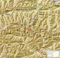
File:Großglockner (Umgebungskarte).png
Appearance

Size of this preview: 800 × 500 pixels. Other resolutions: 320 × 200 pixels | 640 × 400 pixels | 971 × 607 pixels.
Original file (971 × 607 pixels, file size: 685 KB, MIME type: image/png)
File history
Click on a date/time to view the file as it appeared at that time.
| Date/Time | Thumbnail | Dimensions | User | Comment | |
|---|---|---|---|---|---|
| current | 14:53, 18 July 2009 |  | 971 × 607 (685 KB) | Chumwa | Karls am Großglockner → Kals am Großglockner |
| 05:56, 17 July 2009 |  | 971 × 607 (685 KB) | Chumwa | mehrere Anpassungen | |
| 04:44, 17 July 2009 |  | 1,457 × 911 (1.19 MB) | Chumwa | Orientierungskarte besser platziert | |
| 04:31, 17 July 2009 |  | 1,457 × 911 (1.19 MB) | Chumwa | {{Information |Description={{de|Umgebungskarte des Großglockners}} |Author=Maximilian Dörrbecker (Chumwa) |Source=own work, using * a GMT file provided by Lencer containing the topographical ba |
File usage
The following page uses this file:
Global file usage
The following other wikis use this file:
- Usage on ca.wikipedia.org
- Usage on cs.wikipedia.org
- Usage on de.wikipedia.org
- Usage on de.wikivoyage.org
- Usage on eu.wikipedia.org
- Usage on fa.wikipedia.org
- Usage on hr.wikipedia.org
- Usage on pt.wikipedia.org
- Usage on ro.wikipedia.org
- Usage on sh.wikipedia.org
- Usage on uk.wikipedia.org
- Usage on www.wikidata.org


