
File:Fly River Delta-txu-oclc-6552576-sc54-4.jpg

Size of this preview: 795 × 600 pixels. Other resolutions: 318 × 240 pixels | 636 × 480 pixels | 1,018 × 768 pixels | 1,280 × 966 pixels | 2,560 × 1,931 pixels | 5,000 × 3,772 pixels.
Original file (5,000 × 3,772 pixels, file size: 2.88 MB, MIME type: image/jpeg)
| This is a file from the Wikimedia Commons. Information from its description page there is shown below. Commons is a freely licensed media file repository. You can help. |
Summary
| Description |
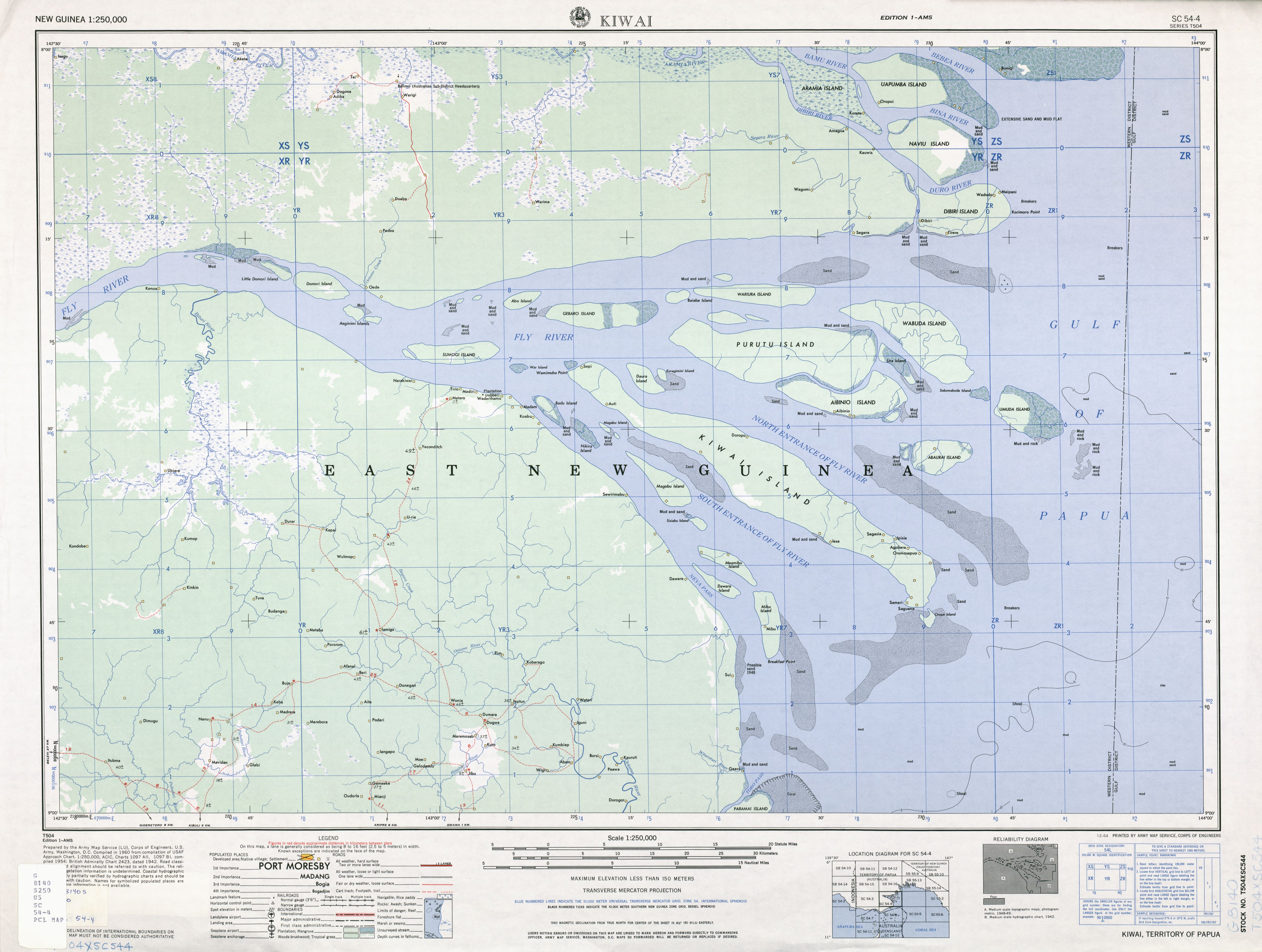
English: 1:250,000 map of Fly River Delta, Western Province, Papua New Guinea |
| Date | |
| Source | http://www.lib.utexas.edu/maps/ams/new_guinea/txu-oclc-6552576-sc54-4.jpg |
| Author | Army Map Service (LU), Corps of Engineers, U.S. Army |
Licensing
This file is a work of a U.S. Army soldier or employee, taken or made as part of that person's official duties. As a work of the U.S. federal government, it is in the public domain in the United States.
|
 |
File history
Click on a date/time to view the file as it appeared at that time.
| Date/Time | Thumbnail | Dimensions | User | Comment | |
|---|---|---|---|---|---|
| current | 11:28, 7 June 2009 | | 5,000 × 3,772 (2.88 MB) | Ratzer | {{Information |Description={{en|1=1:250,000 map of Fly River Delta, Western Province, Papua New Guinea}} |Source=http://www.lib.utexas.edu/maps/ams/new_guinea/txu-oclc-6552576-sc54-4.jpg |Author=Army Map Service (LU), Corps of Engineers, U.S. Army |Date=1 |
File usage
The following 4 pages use this file:
Global file usage
The following other wikis use this file:
- Usage on als.wikipedia.org
- Usage on ast.wikipedia.org
- Usage on az.wikipedia.org
- Usage on ceb.wikipedia.org
- Usage on cv.wikipedia.org
- Usage on de.wikipedia.org
- Usage on eo.wikipedia.org
- Usage on es.wikipedia.org
- Usage on et.wikipedia.org
- Usage on fr.wikipedia.org
- Usage on hy.wikipedia.org
- Usage on it.wikipedia.org
- Usage on nl.wikipedia.org
- Usage on pt.wikipedia.org
- Usage on ru.wikipedia.org
- Usage on sr.wikipedia.org
- Usage on uk.wikipedia.org
- Usage on www.wikidata.org
- Usage on zh.wikipedia.org