
File:Fig 11LG.jpg

No higher resolution available.
Fig_11LG.jpg (600 × 409 pixels, file size: 51 KB, MIME type: image/jpeg)
| This is a file from the Wikimedia Commons. Information from its description page there is shown below. Commons is a freely licensed media file repository. You can help. |
Summary
| Description |
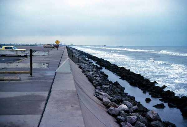
English: This example of multiple structures includes a massive seawall and riprap revetment. |
| Source |
https://pubs.usgs.gov/of/2005/1370/figures/fig11.html Credit: U. S. Geological Survey |
| Author |
Credit: U. S. Geological Survey U. S. Geological Survey USGS/Ft. Collins, CO |
Licensing
This image is in the public domain in the United States because it only contains materials that originally came from the United States Geological Survey, an agency of the United States Department of the Interior. For more information, see the official USGS copyright policy.
|
File history
Click on a date/time to view the file as it appeared at that time.
| Date/Time | Thumbnail | Dimensions | User | Comment | |
|---|---|---|---|---|---|
| current | 07:06, 6 March 2007 | | 600 × 409 (51 KB) | Geol310 mera | Coastal Classification Atlas Southeast Texas Coastal Classification Maps - Sabine Pass to the Colorado River USGS Open File Report 2005-1370 http://pubs.usgs.gov/of/2005/1370/images/Fig_11LG.jpg |
File usage
The following 2 pages use this file: