
File:Eritrea and Northern Ethiopia shaded relief map 1999, CIA.jpg

Size of this preview: 506 × 600 pixels. Other resolutions: 202 × 240 pixels | 405 × 480 pixels | 648 × 768 pixels | 1,070 × 1,268 pixels.
Original file (1,070 × 1,268 pixels, file size: 322 KB, MIME type: image/jpeg)
| This is a file from the Wikimedia Commons. Information from its description page there is shown below. Commons is a freely licensed media file repository. You can help. |
Summary
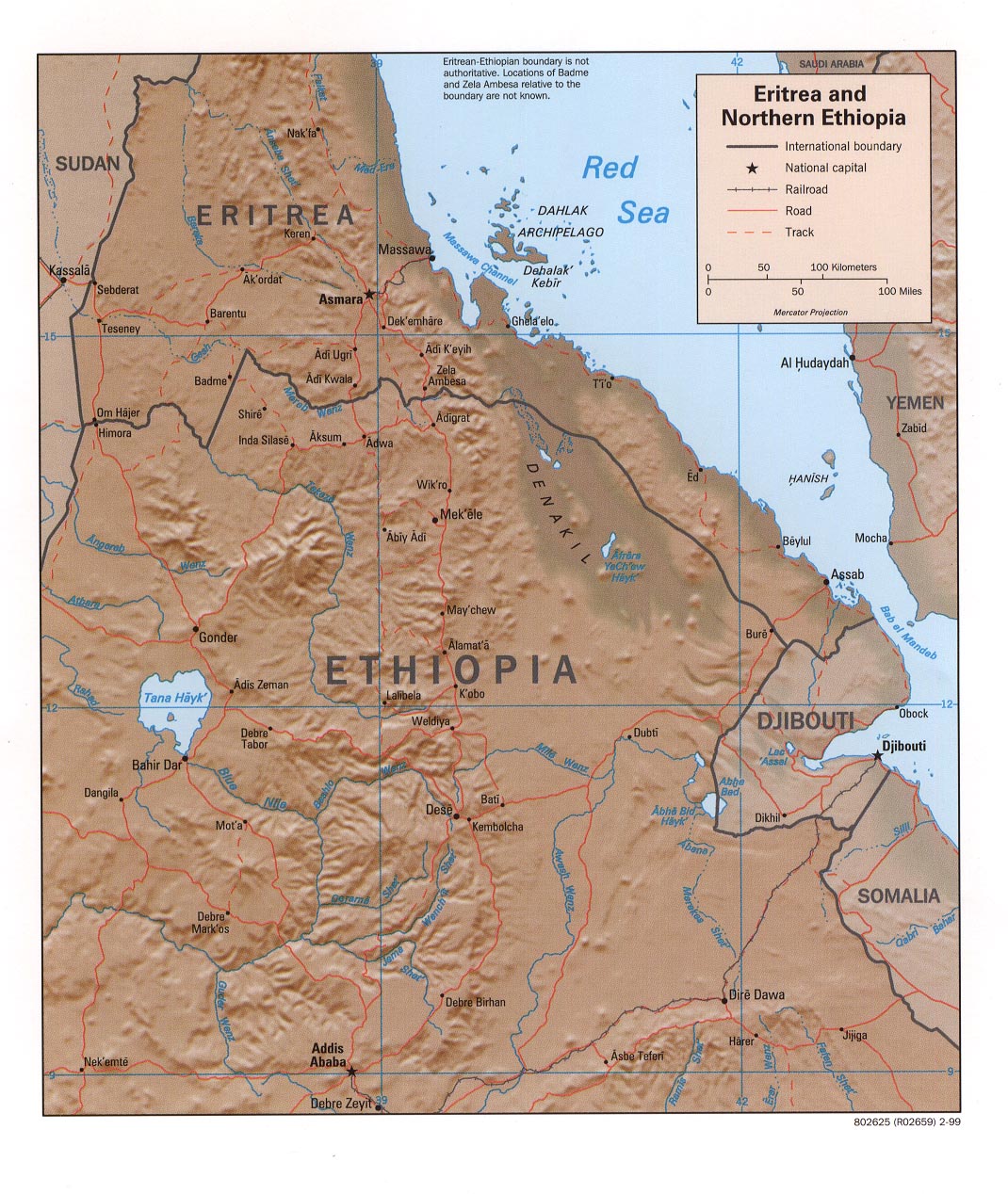
| Description | Eritrea and Northern Ethiopia (Shaded Relief), 1999 |
| Date | |
| Source |
University of Texas Libraries, Perry-Castañeda Library Map Collection: Ethiopia Maps |
| Author | CIA |
Licensing
| This image is a work of a Central Intelligence Agency employee, taken or made as part of that person's official duties. As a Work of the United States Government, this image or media is in the public domain in the United States.
|

|
File history
Click on a date/time to view the file as it appeared at that time.
| Date/Time | Thumbnail | Dimensions | User | Comment | |
|---|---|---|---|---|---|
| current | 17:35, 27 September 2005 | | 1,070 × 1,268 (322 KB) | Andro96~commonswiki | Eritrea and Northern Ethiopia (Shaded Relief) 1999 map was produced by the U.S. Central Intelligence Agency http://www.lib.utexas.edu/maps/ethiopia.html |
File usage
The following page uses this file:
Global file usage
The following other wikis use this file:
- Usage on ca.wikipedia.org
- Usage on ckb.wikipedia.org
- Usage on de.wikipedia.org
- Usage on de.wikibooks.org
- Usage on fa.wikipedia.org
- Usage on id.wikipedia.org
- Usage on mzn.wikipedia.org
- Usage on nl.wikipedia.org
- Usage on www.wikidata.org
- Usage on zh.wikipedia.org