
File:Davis-Schrimpf Seep Field.jpg
Size of this preview: 800 × 450 pixels. Other resolutions: 320 × 180 pixels | 640 × 360 pixels | 1,024 × 576 pixels | 1,280 × 720 pixels | 3,556 × 2,000 pixels.
Original file (3,556 × 2,000 pixels, file size: 1.61 MB, MIME type: image/jpeg)
| This is a file from the Wikimedia Commons. Information from its description page there is shown below. Commons is a freely licensed media file repository. You can help. |
Summary
| Description |
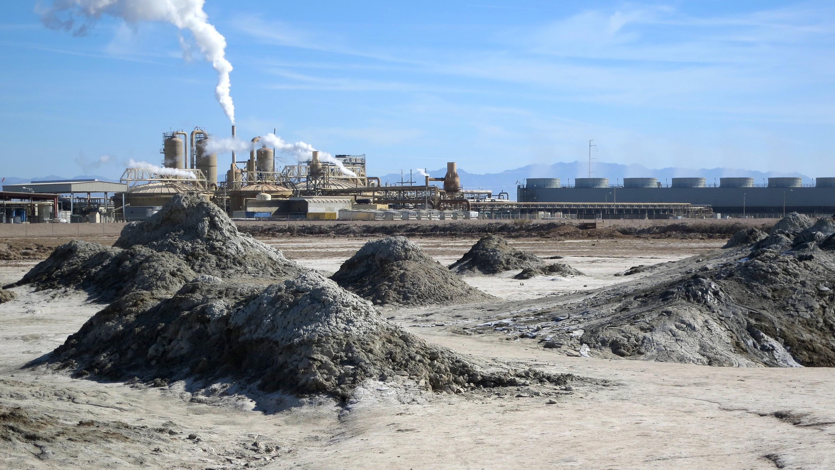
English: Mud volcanos and mud pots in the foreground and a geothermal power plant beyond. These natural phenomena are there for you tto explore. On the day I went with my friend, we ran into a couple of older men who had come to rub the mud all over themselves. Apparently, there are hot springs a few miles away where they intended to rinse off.
The J.L. Featherstone Geothermal Power Plant lies in the distance. |
| Date | |
| Source | https://www.flickr.com/photos/chrishunkeler/26263229662/ |
| Author | Chris Hunkeler |
| Permission (Reusing this file) |
Photo credit: Chris Hunkeler |
| Camera location | | View this and other nearby images on: OpenStreetMap |
|---|
Increased exposure slightly before uploading from Flickr.
Licensing
| This image, originally posted to Flickr, was reviewed on 8 February 2020 by the administrator or reviewer Leoboudv, who confirmed that it was available on Flickr under the stated license on that date. |
This file is licensed under the Creative Commons Attribution-Share Alike 2.0 Generic license.
- You are free:
- to share – to copy, distribute and transmit the work
- to remix – to adapt the work
- Under the following conditions:
- attribution – You must give appropriate credit, provide a link to the license, and indicate if changes were made. You may do so in any reasonable manner, but not in any way that suggests the licensor endorses you or your use.
- share alike – If you remix, transform, or build upon the material, you must distribute your contributions under the same or compatible license as the original.
File history
Click on a date/time to view the file as it appeared at that time.
| Date/Time | Thumbnail | Dimensions | User | Comment | |
|---|---|---|---|---|---|
| current | 18:23, 7 February 2020 | | 3,556 × 2,000 (1.61 MB) | Ponderosapine210 | User created page with UploadWizard |
File usage
The following page uses this file: