
File:Carroll County Arkansas 2010 Township Map large.jpg
Size of this preview: 753 × 599 pixels. Other resolutions: 302 × 240 pixels | 603 × 480 pixels | 965 × 768 pixels | 1,280 × 1,019 pixels | 2,560 × 2,038 pixels | 3,000 × 2,388 pixels.
Original file (3,000 × 2,388 pixels, file size: 836 KB, MIME type: image/jpeg)
| This is a file from the Wikimedia Commons. Information from its description page there is shown below. Commons is a freely licensed media file repository. You can help. |
Summary
| Description |
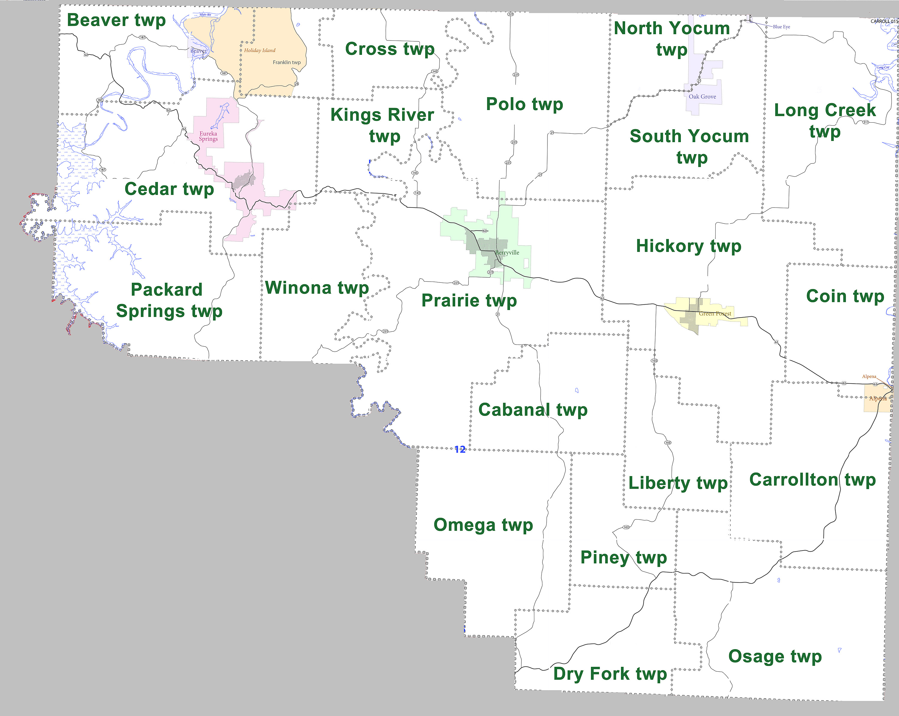
English: Larger version of map showing townships in Carroll County, Arkansas as of 2010. Modified from US census map (for 2010 census) for Carroll County, Arkansas |
| Date | 27 July 2011 |
| Source | Own work |
| Author | Yx7791 (talk) (Uploads) |
Licensing
I, the copyright holder of this work, hereby publish it under the following license:
| This file is made available under the Creative Commons CC0 1.0 Universal Public Domain Dedication. | |
| The person who associated a work with this deed has dedicated the work to the public domain by waiving all of their rights to the work worldwide under copyright law, including all related and neighboring rights, to the extent allowed by law. You can copy, modify, distribute and perform the work, even for commercial purposes, all without asking permission.
|
File history
Click on a date/time to view the file as it appeared at that time.
| Date/Time | Thumbnail | Dimensions | User | Comment | |
|---|---|---|---|---|---|
| current | 23:05, 27 July 2011 | | 3,000 × 2,388 (836 KB) | Yx7791 | Larger version of map showing townships in Carroll County, Arkansas. Modified from [http://www2.census.gov/geo/maps/dc10map/GUBlock/st05_ar/county/c05015_carroll/DC10BLK_C05015_000.pdf US census map (for 2010 census) for Carroll County, Arkansas] |
File usage
The following page uses this file:
Global file usage
The following other wikis use this file:
- Usage on arz.wikipedia.org