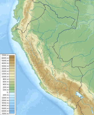
Chayu Nain Communal Reserve
| Chayu Nain Communal Reserve | |
|---|---|
| Reserva Comunal Chayu Nain | |
IUCN category VI (protected area with sustainable use of natural resources) | |
| Location | Bagua Province and Utcubamba Province, Amazonas Region, Peru |
| Coordinates | 5°26′26″S 78°15′26″W / 5.44056°S 78.25722°W |
| Area | 23,597.76 ha (58,311.3 acres) |
| Established | December 9, 2009 |
| Governing body | SERNANP |
| Website | www.sernanp.gob.pe |
The Chayu Nain Communal Reserve (Spanish: Reserva Comunal Chayu Nain) is a protected area in the Amazonas Region of northern Peru, located in the districts of Aramango, Imaza, and Cajaruro, spanning the provinces of Bagua and Utcubamba.[1]
The reserve was officially created on December 9, 2009, through Supreme Decree No. 021-2009-MINAM. It covers an area of 23,597.76 hectares (58,311.3 acres) and is part of Peru's National System of Natural Protected Areas.[2]
The reserve is home to key species such as the yellow-tailed woolly monkey (Oreonax flavicauda), spectacled bear (Tremarctos ornatus), and South American tapir (Tapirus terrestris). Unique birdlife and a recently described endemic marsupial, Caenolestes condorensis, have also been recorded. Vegetation includes high-altitude shrublands and grasslands on sandstone formations of the Cordillera del Cóndor.[3][2]
See also
[edit]References
[edit]- ^ "Chayu Nain". SERNANP. Archived from the original on 7 August 2016. Retrieved 22 July 2015.
- ^ a b "Reserva Comunal Chayu Nain". Plataforma del Estado Peruano (in Spanish). Retrieved 2025-08-06.
- ^ Plan Maestro de la Reserva Comunal Chayu Nain [Master Plan for the Chayu Nain Communal Reserve] (PDF) (in Spanish) (1st ed.). Lima: National Service of Natural Protected Areas. 2017. Retrieved 2025-08-06.

